

Südlicher Steigerw.130km1150hm
A cycling route starting in Fürth, Bavaria, Germany.
Overview
About this route
- -:--
- Duration
- 107.4 km
- Distance
- 582 m
- Ascent
- 585 m
- Descent
- ---
- Avg. speed
- ---
- Avg. speed
Route highlights
Points of interest along the route
Point of interest after 50.3 km
Continue with Bikemap
Use, edit, or download this cycling route
You would like to ride Südlicher Steigerw.130km1150hm or customize it for your own trip? Here is what you can do with this Bikemap route:
Free features
- Save this route as favorite or in collections
- Copy & plan your own version of this route
- Sync your route with Garmin or Wahoo
Premium features
Free trial for 3 days, or one-time payment. More about Bikemap Premium.
- Navigate this route on iOS & Android
- Export a GPX / KML file of this route
- Create your custom printout (try it for free)
- Download this route for offline navigation
Discover more Premium features.
Get Bikemap PremiumFrom our community
Other popular routes starting in Fürth
 Fürth-Puschendorf-Obermichelbach
- Distance
- 76 km
- Ascent
- 429 m
- Descent
- 428 m
- Location
- Fürth, Bavaria, Germany
 Cadolzburg-Veitsbronn-Tour
- Distance
- 39.1 km
- Ascent
- 235 m
- Descent
- 235 m
- Location
- Fürth, Bavaria, Germany
 Fürth-Nürnberg-Moritzberg-Fürth
- Distance
- 77.6 km
- Ascent
- 727 m
- Descent
- 714 m
- Location
- Fürth, Bavaria, Germany
 Nuremberg
- Distance
- 17.1 km
- Ascent
- 102 m
- Descent
- 83 m
- Location
- Fürth, Bavaria, Germany
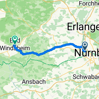 Fürth Hbf - Bad Windsheim Martin-Luther-Platz
- Distance
- 54.1 km
- Ascent
- 336 m
- Descent
- 304 m
- Location
- Fürth, Bavaria, Germany
 Kidical Mass Update
- Distance
- 8 km
- Ascent
- 25 m
- Descent
- 33 m
- Location
- Fürth, Bavaria, Germany
 Hausrunde 60km
- Distance
- 57.8 km
- Ascent
- 568 m
- Descent
- 573 m
- Location
- Fürth, Bavaria, Germany
 Kurze Radtour zum Kanal
- Distance
- 11.3 km
- Ascent
- 87 m
- Descent
- 87 m
- Location
- Fürth, Bavaria, Germany
Open it in the app