

Rzeszów - Łańcut - Rzeszów omijając główną
A cycling route starting in Rzeszów, Subcarpathian Voivodeship, Poland.
Overview
About this route
A fairly easy and pleasant route to Łańcut and back. We avoid the main road, so it's quite enjoyable to ride. Most of the route is paved. You can comfortably ride with someone who doesn't bike much. In practice, there's only one hill before Łańcut, which might pose a slight challenge ;-)
For a break, it's good to stop at the park near the castle in Łańcut.
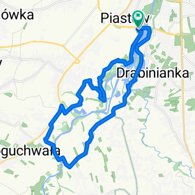
Route overview: Rzeszów -> Załęże -> Krasne -> Strażów.
To get to Strażów, there are 2 ways:
- Turn left at the intersection – road through fields – no asphalt. If it's not wet, it's fine ;-) (shorter and flat)
- Turn right – uphill, then you have to turn left, downhill to the right, and straight ahead. (all asphalt, but slightly more tiring and longer). When choosing this route, before Strażów turn left to reach the eagle monument.
Once you reach Strażów (at the eagle monument), continue east. On the map, you can't see the road, even though it's paved. Stay on the main road all the time and you'll arrive where you need to ;)
After resting in Łańcut, head toward Mickiewicza, then straight ahead (crossing the E40). Ride toward Albigowa, turn right to Kraczkowa. Then stay on the main road and you'll be in Rzeszów.
- -:--
- Duration
- 39.6 km
- Distance
- 187 m
- Ascent
- 187 m
- Descent
- ---
- Avg. speed
- ---
- Max. altitude
Route quality
Waytypes & surfaces along the route
Waytypes
Road
19 km
(48 %)
Quiet road
10.7 km
(27 %)
Surfaces
Paved
35.2 km
(89 %)
Asphalt
35.2 km
(89 %)
Undefined
4.4 km
(11 %)
Route highlights
Points of interest along the route
Point of interest after 11.3 km
Tutaj nie kończy się tak naprawdę droga. Jest lekko pod górkę, minimalnie kręta. Wyznaczyłem trasę na podstawie zdjęć satelitarnych
Point of interest after 19.4 km
W ramach odpoczynku, warto odwiedzić zamek w Łańcucie. Należy pamiętać, że po parku nie można jeździć. Rower niestety trzeba prowadzić.
Continue with Bikemap
Use, edit, or download this cycling route
You would like to ride Rzeszów - Łańcut - Rzeszów omijając główną or customize it for your own trip? Here is what you can do with this Bikemap route:
Free features
- Save this route as favorite or in collections
- Copy & plan your own version of this route
- Sync your route with Garmin or Wahoo
Premium features
Free trial for 3 days, or one-time payment. More about Bikemap Premium.
- Navigate this route on iOS & Android
- Export a GPX / KML file of this route
- Create your custom printout (try it for free)
- Download this route for offline navigation
Discover more Premium features.
Get Bikemap PremiumFrom our community
Other popular routes starting in Rzeszów
 Objazd Wisłoka nocom, gdzie żabole rechocom
- Distance
- 15.7 km
- Ascent
- 44 m
- Descent
- 41 m
- Location
- Rzeszów, Subcarpathian Voivodeship, Poland
 Rzeszów - Dynów po górkach
- Distance
- 94 km
- Ascent
- 857 m
- Descent
- 846 m
- Location
- Rzeszów, Subcarpathian Voivodeship, Poland
 Boguchwała
- Distance
- 19.4 km
- Ascent
- 71 m
- Descent
- 71 m
- Location
- Rzeszów, Subcarpathian Voivodeship, Poland
 Rzeszów - Przylasek - Sołonka - Babica - Krzyż Milenijny - Rzeszów
- Distance
- 64.5 km
- Ascent
- 598 m
- Descent
- 598 m
- Location
- Rzeszów, Subcarpathian Voivodeship, Poland
 Rzeszów, Terliczka, Czarna, Łańcut, Kraczkowa, Malawa, Rzeszów
- Distance
- 43 km
- Ascent
- 119 m
- Descent
- 122 m
- Location
- Rzeszów, Subcarpathian Voivodeship, Poland
![[V] #054 Babia Góra](https://media.bikemap.net/routes/7432964/staticmaps/in_34552177-a112-4354-9da4-48307a0dcf74_400x400_bikemap-2021-3D-static.png) [V] #054 Babia Góra
[V] #054 Babia Góra- Distance
- 38.4 km
- Ascent
- 220 m
- Descent
- 219 m
- Location
- Rzeszów, Subcarpathian Voivodeship, Poland
 Wisząca kładka
- Distance
- 17.6 km
- Ascent
- 114 m
- Descent
- 122 m
- Location
- Rzeszów, Subcarpathian Voivodeship, Poland
 Trasa 2
- Distance
- 14.9 km
- Ascent
- 14 m
- Descent
- 13 m
- Location
- Rzeszów, Subcarpathian Voivodeship, Poland
Open it in the app