

Ilmenau -Hohewarte - Ilmenau
A cycling route starting in Langewiesen, Thuringia, Germany.
Overview
About this route
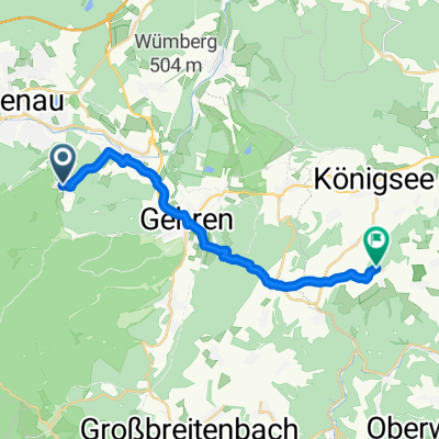
Ilmenau - Langwiesen - Grafinau Angstedt - Kloster Paulinzella - Milbitz - Watzdorf - Saalfeld - Kleinkamsdorf - Hohewarte - Kaulsdorf - Saalfeld - Bad Blankenburg - Paulinzella - Ilmenau
- -:--
- Duration
- 121 km
- Distance
- 868 m
- Ascent
- 781 m
- Descent
- ---
- Avg. speed
- ---
- Max. altitude

Route quality
Waytypes & surfaces along the route
Waytypes
Quiet road
35.7 km
(30 %)
Path
25.4 km
(21 %)
Surfaces
Paved
90.8 km
(75 %)
Unpaved
16.4 km
(14 %)
Asphalt
84 km
(69 %)
Gravel
7.4 km
(6 %)
Continue with Bikemap
Use, edit, or download this cycling route
You would like to ride Ilmenau -Hohewarte - Ilmenau or customize it for your own trip? Here is what you can do with this Bikemap route:
Free features
- Save this route as favorite or in collections
- Copy & plan your own version of this route
- Split it into stages to create a multi-day tour
- Sync your route with Garmin or Wahoo
Premium features
Free trial for 3 days, or one-time payment. More about Bikemap Premium.
- Navigate this route on iOS & Android
- Export a GPX / KML file of this route
- Create your custom printout (try it for free)
- Download this route for offline navigation
Discover more Premium features.
Get Bikemap PremiumFrom our community
Other popular routes starting in Langewiesen
 Ilmenau -Hohewarte - Ilmenau
- Distance
- 121 km
- Ascent
- 868 m
- Descent
- 781 m
- Location
- Langewiesen, Thuringia, Germany
 Ilmenau - Vessertal
- Distance
- 70.9 km
- Ascent
- 956 m
- Descent
- 953 m
- Location
- Langewiesen, Thuringia, Germany
 Barigauer Turm
- Distance
- 15.6 km
- Ascent
- 335 m
- Descent
- 318 m
- Location
- Langewiesen, Thuringia, Germany
 Stadtilm - Paulinzella
- Distance
- 47.8 km
- Ascent
- 389 m
- Descent
- 389 m
- Location
- Langewiesen, Thuringia, Germany
 Rundkurs Langewiesen-Gehren-GräfinauAngstedt-Wümbach-Langewiesen
- Distance
- 17 km
- Ascent
- 150 m
- Descent
- 150 m
- Location
- Langewiesen, Thuringia, Germany
 Oberhof
- Distance
- 81.7 km
- Ascent
- 804 m
- Descent
- 804 m
- Location
- Langewiesen, Thuringia, Germany
 suhl euerdorf
- Distance
- 128.1 km
- Ascent
- 849 m
- Descent
- 1,111 m
- Location
- Langewiesen, Thuringia, Germany
 kurzer strip
- Distance
- 10.5 km
- Ascent
- 74 m
- Descent
- 97 m
- Location
- Langewiesen, Thuringia, Germany
Open it in the app