

Gen Osten
Zürich Altstätten über Wil
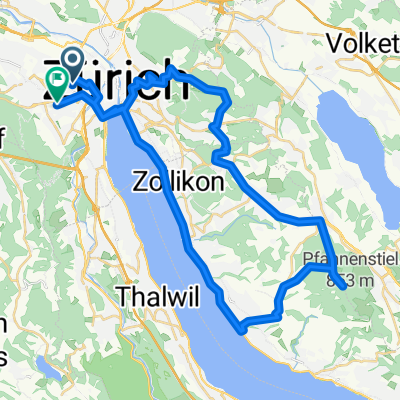
A cycling route starting in Zürich (Kreis 4) / Aussersihl, Canton of Zurich, Switzerland.
Overview
About this route
- -:--
- Duration
- 108 km
- Distance
- 1,119 m
- Ascent
- 1,068 m
- Descent
- ---
- Avg. speed
- ---
- Max. altitude

Part of
Gen Osten
4 stages
Route quality
Waytypes & surfaces along the route
Waytypes
Quiet road
48 km
(44 %)
Road
23 km
(21 %)
Surfaces
Paved
82.2 km
(76 %)
Unpaved
10.7 km
(10 %)
Asphalt
78.2 km
(72 %)
Gravel
10.1 km
(9 %)
Continue with Bikemap
Use, edit, or download this cycling route
You would like to ride Zürich Altstätten über Wil or customize it for your own trip? Here is what you can do with this Bikemap route:
Free features
- Save this route as favorite or in collections
- Copy & plan your own version of this route
- Split it into stages to create a multi-day tour
- Sync your route with Garmin or Wahoo
Premium features
Free trial for 3 days, or one-time payment. More about Bikemap Premium.
- Navigate this route on iOS & Android
- Export a GPX / KML file of this route
- Create your custom printout (try it for free)
- Download this route for offline navigation
Discover more Premium features.
Get Bikemap PremiumFrom our community
Other popular routes starting in Zürich (Kreis 4) / Aussersihl
 Zurich - Rapperswil
- Distance
- 31.4 km
- Ascent
- 134 m
- Descent
- 101 m
- Location
- Zürich (Kreis 4) / Aussersihl, Canton of Zurich, Switzerland
 Üetliberg umfahren
- Distance
- 31.1 km
- Ascent
- 473 m
- Descent
- 473 m
- Location
- Zürich (Kreis 4) / Aussersihl, Canton of Zurich, Switzerland
 Zürich-Pfannenstil-Zürich
- Distance
- 46.6 km
- Ascent
- 577 m
- Descent
- 562 m
- Location
- Zürich (Kreis 4) / Aussersihl, Canton of Zurich, Switzerland
 Züri-Sattelegg-Züri
- Distance
- 104.7 km
- Ascent
- 924 m
- Descent
- 921 m
- Location
- Zürich (Kreis 4) / Aussersihl, Canton of Zurich, Switzerland
 bike tour from Zürich to Bonstetten
- Distance
- 16.7 km
- Ascent
- 311 m
- Descent
- 183 m
- Location
- Zürich (Kreis 4) / Aussersihl, Canton of Zurich, Switzerland
 abendrunde heitersberg
- Distance
- 44.9 km
- Ascent
- 551 m
- Descent
- 551 m
- Location
- Zürich (Kreis 4) / Aussersihl, Canton of Zurich, Switzerland
 Uetliberg
- Distance
- 15.1 km
- Ascent
- 485 m
- Descent
- 483 m
- Location
- Zürich (Kreis 4) / Aussersihl, Canton of Zurich, Switzerland
 Türlersee Rundfahrt
- Distance
- 51.9 km
- Ascent
- 637 m
- Descent
- 644 m
- Location
- Zürich (Kreis 4) / Aussersihl, Canton of Zurich, Switzerland
Open it in the app