

San Martin - chajda Taistner Vonderalm
A cycling route starting in San Martino, Trentino-Alto Adige, Italy.
Overview
About this route
average gradient: 7 %
maximum gradient: 24 %
the descent to the Taistner Hinteralm hut is sometimes unrideable by bike
- -:--
- Duration
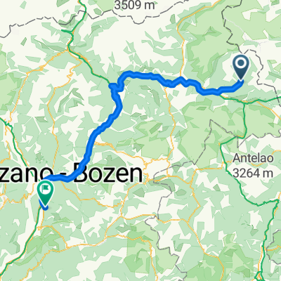
- 50.9 km
- Distance
- 1,452 m
- Ascent
- 1,452 m
- Descent
- ---
- Avg. speed
- ---
- Max. altitude
Continue with Bikemap
Use, edit, or download this cycling route
You would like to ride San Martin - chajda Taistner Vonderalm or customize it for your own trip? Here is what you can do with this Bikemap route:
Free features
- Save this route as favorite or in collections
- Copy & plan your own version of this route
- Sync your route with Garmin or Wahoo
Premium features
Free trial for 3 days, or one-time payment. More about Bikemap Premium.
- Navigate this route on iOS & Android
- Export a GPX / KML file of this route
- Create your custom printout (try it for free)
- Download this route for offline navigation
Discover more Premium features.
Get Bikemap PremiumFrom our community
Other popular routes starting in San Martino
 San Martin - chajda Weisbachalm CLONED FROM ROUTE 237076
- Distance
- 9.5 km
- Ascent
- 879 m
- Descent
- 31 m
- Location
- San Martino, Trentino-Alto Adige, Italy
 Lake Anterselva - Valdaora
- Distance
- 20.1 km
- Ascent
- 0 m
- Descent
- 0 m
- Location
- San Martino, Trentino-Alto Adige, Italy
 VAL CASIES - Monguelfo - Fortezza+Novacella - Bronx
- Distance
- 130 km
- Ascent
- 163 m
- Descent
- 1,127 m
- Location
- San Martino, Trentino-Alto Adige, Italy
 20200715 Valli Casies e Anterselva
- Distance
- 62.8 km
- Ascent
- 1,535 m
- Descent
- 1,535 m
- Location
- San Martino, Trentino-Alto Adige, Italy
 20200712 Anello di St. Magdalena Gsies
- Distance
- 15.3 km
- Ascent
- 558 m
- Descent
- 560 m
- Location
- San Martino, Trentino-Alto Adige, Italy
 San Martin - chajda Taistner Vonderalm
- Distance
- 50.9 km
- Ascent
- 1,452 m
- Descent
- 1,452 m
- Location
- San Martino, Trentino-Alto Adige, Italy
 3a tappa traversata delle alpi
- Distance
- 81.4 km
- Ascent
- 422 m
- Descent
- 912 m
- Location
- San Martino, Trentino-Alto Adige, Italy
 Von Antholz nach Matrei
- Distance
- 53.1 km
- Ascent
- 987 m
- Descent
- 1,328 m
- Location
- San Martino, Trentino-Alto Adige, Italy
Open it in the app