

BFH Kochendorf/Zuhause - Bramb' Hof - Neuenstadt - Ko'türn - Stein - Lobenb' Hof - Hohe Straße - U'griesheim - O'griesheim - Gundelsheim - Heinsheim - Neckar -
A cycling route starting in Untereisesheim, Baden-Wurttemberg, Germany.
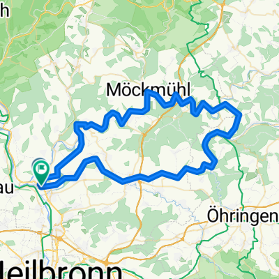
Overview
About this route
- -:--
- Duration
- 41 km
- Distance
- 276 m
- Ascent
- 276 m
- Descent
- ---
- Avg. speed
- ---
- Max. altitude

Route quality
Waytypes & surfaces along the route
Waytypes
Track
24.2 km
(59 %)
Quiet road
7.4 km
(18 %)
Surfaces
Paved
34.8 km
(85 %)
Unpaved
1.6 km
(4 %)
Asphalt
34 km
(83 %)
Gravel
1.2 km
(3 %)
Continue with Bikemap
Use, edit, or download this cycling route
You would like to ride BFH Kochendorf/Zuhause - Bramb' Hof - Neuenstadt - Ko'türn - Stein - Lobenb' Hof - Hohe Straße - U'griesheim - O'griesheim - Gundelsheim - Heinsheim - Neckar - or customize it for your own trip? Here is what you can do with this Bikemap route:
Free features
- Save this route as favorite or in collections
- Copy & plan your own version of this route
- Sync your route with Garmin or Wahoo
Premium features
Free trial for 3 days, or one-time payment. More about Bikemap Premium.
- Navigate this route on iOS & Android
- Export a GPX / KML file of this route
- Create your custom printout (try it for free)
- Download this route for offline navigation
Discover more Premium features.
Get Bikemap PremiumFrom our community
Other popular routes starting in Untereisesheim
 Tour de Burg Hornberg Extended
- Distance
- 67.8 km
- Ascent
- 637 m
- Descent
- 637 m
- Location
- Untereisesheim, Baden-Wurttemberg, Germany
 Bad Friedrichshall - Jagst
- Distance
- 18.8 km
- Ascent
- 140 m
- Descent
- 143 m
- Location
- Untereisesheim, Baden-Wurttemberg, Germany
 Brettachtalrunde
- Distance
- 77.3 km
- Ascent
- 730 m
- Descent
- 729 m
- Location
- Untereisesheim, Baden-Wurttemberg, Germany
 Bad Friedrichshall-Jagshausen-Runde
- Distance
- 78.7 km
- Ascent
- 545 m
- Descent
- 544 m
- Location
- Untereisesheim, Baden-Wurttemberg, Germany
 NE - Kochendorf - Singletrail NE Dahenfeld - Scheppach - Obersulm - Erlenbach - NE
- Distance
- 51.7 km
- Ascent
- 288 m
- Descent
- 288 m
- Location
- Untereisesheim, Baden-Wurttemberg, Germany
 Von Bad Friedrichshall bis Limbach
- Distance
- 46 km
- Ascent
- 733 m
- Descent
- 502 m
- Location
- Untereisesheim, Baden-Wurttemberg, Germany
 Bad Friedrichshall-Jagsthausen
- Distance
- 73.2 km
- Ascent
- 996 m
- Descent
- 994 m
- Location
- Untereisesheim, Baden-Wurttemberg, Germany
 Bad Friedrichshall-Jagsthausen_V2
- Distance
- 60.4 km
- Ascent
- 725 m
- Descent
- 724 m
- Location
- Untereisesheim, Baden-Wurttemberg, Germany
Open it in the app