
GY - 2HR upload
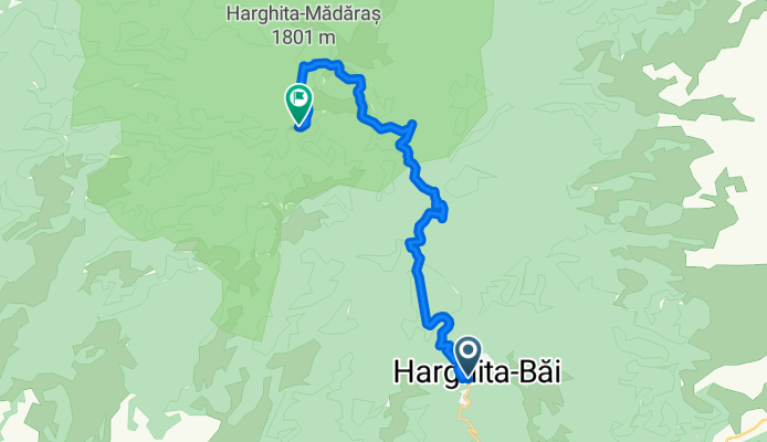
A cycling route starting in Căpâlniţa, Harghita County, Romania.
Overview
About this route
null
- -:--
- Duration
- 16 km
- Distance
- 859 m
- Ascent
- 597 m
- Descent
- ---
- Avg. speed
- ---
- Max. altitude

Route photos

Continue with Bikemap
Use, edit, or download this cycling route
You would like to ride GY - 2HR upload or customize it for your own trip? Here is what you can do with this Bikemap route:
Free features
- Save this route as favorite or in collections
- Copy & plan your own version of this route
- Sync your route with Garmin or Wahoo
Premium features
Free trial for 3 days, or one-time payment. More about Bikemap Premium.
- Navigate this route on iOS & Android
- Export a GPX / KML file of this route
- Create your custom printout (try it for free)
- Download this route for offline navigation
Discover more Premium features.
Get Bikemap PremiumFrom our community
Other popular routes starting in Căpâlniţa
 Elvesztünk a Hargitán
- Distance
- 34.7 km
- Ascent
- 94 m
- Descent
- 1,220 m
- Location
- Căpâlniţa, Harghita County, Romania
 Mtii Harghita
- Distance
- 49.6 km
- Ascent
- 1,415 m
- Descent
- 1,426 m
- Location
- Căpâlniţa, Harghita County, Romania
 SZT / Hargita - Zetelaka
- Distance
- 54.4 km
- Ascent
- 1,197 m
- Descent
- 1,204 m
- Location
- Căpâlniţa, Harghita County, Romania
 SZT / Hargita - Kapolnas
- Distance
- 35.8 km
- Ascent
- 904 m
- Descent
- 901 m
- Location
- Căpâlniţa, Harghita County, Romania
 Hargita Csicsó-Madaras
- Distance
- 13.3 km
- Ascent
- 485 m
- Descent
- 591 m
- Location
- Căpâlniţa, Harghita County, Romania
 Ski Tura Madarasi
- Distance
- 12.6 km
- Ascent
- 812 m
- Descent
- 812 m
- Location
- Căpâlniţa, Harghita County, Romania
 Hargita csucs
- Distance
- 11.2 km
- Ascent
- 607 m
- Descent
- 183 m
- Location
- Căpâlniţa, Harghita County, Romania
 GY - 2HR upload
- Distance
- 16 km
- Ascent
- 859 m
- Descent
- 597 m
- Location
- Căpâlniţa, Harghita County, Romania
Open it in the app