
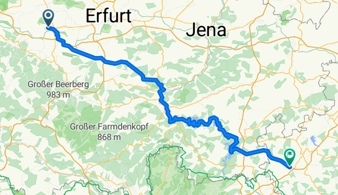
2018 Tour 2 (Saale, Voigtland)
A cycling route starting in Gotha, Thuringia, Germany.
Overview
About this route
- -:--
- Duration
- 167.7 km
- Distance
- 2,856 m
- Ascent
- 2,779 m
- Descent
- ---
- Avg. speed
- ---
- Max. altitude

Route quality
Waytypes & surfaces along the route
Waytypes
Track
40.2 km
(24 %)
Quiet road
28.5 km
(17 %)
Surfaces
Paved
119.1 km
(71 %)
Unpaved
26.8 km
(16 %)
Asphalt
112.4 km
(67 %)
Gravel
21.8 km
(13 %)
Continue with Bikemap
Use, edit, or download this cycling route
You would like to ride 2018 Tour 2 (Saale, Voigtland) or customize it for your own trip? Here is what you can do with this Bikemap route:
Free features
- Save this route as favorite or in collections
- Copy & plan your own version of this route
- Split it into stages to create a multi-day tour
- Sync your route with Garmin or Wahoo
Premium features
Free trial for 3 days, or one-time payment. More about Bikemap Premium.
- Navigate this route on iOS & Android
- Export a GPX / KML file of this route
- Create your custom printout (try it for free)
- Download this route for offline navigation
Discover more Premium features.
Get Bikemap PremiumFrom our community
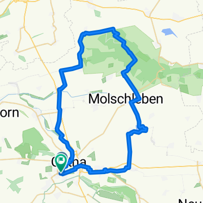
Other popular routes starting in Gotha
 Düppel-Rundfahrt
- Distance
- 23.1 km
- Ascent
- 250 m
- Descent
- 294 m
- Location
- Gotha, Thuringia, Germany
 Moderate Montag Track In Gotha
- Distance
- 19.5 km
- Ascent
- 384 m
- Descent
- 380 m
- Location
- Gotha, Thuringia, Germany
 Wechmarer Hütte
- Distance
- 41.6 km
- Ascent
- 391 m
- Descent
- 388 m
- Location
- Gotha, Thuringia, Germany
 Brieglebstraße, Gotha nach Friedensstraße, Hörsel
- Distance
- 11 km
- Ascent
- 79 m
- Descent
- 63 m
- Location
- Gotha, Thuringia, Germany
 Gotha - Hörselgau - Gotha
- Distance
- 34.3 km
- Ascent
- 242 m
- Descent
- 245 m
- Location
- Gotha, Thuringia, Germany
 Von Gotha bis Hörsel
- Distance
- 44.6 km
- Ascent
- 381 m
- Descent
- 379 m
- Location
- Gotha, Thuringia, Germany
 Waltershäuser Straße, Gotha nach Waltershäuser Straße, Gotha
- Distance
- 48.7 km
- Ascent
- 384 m
- Descent
- 382 m
- Location
- Gotha, Thuringia, Germany
 Rund um Gotha (Süd-West)
- Distance
- 29.4 km
- Ascent
- 189 m
- Descent
- 176 m
- Location
- Gotha, Thuringia, Germany
Open it in the app