

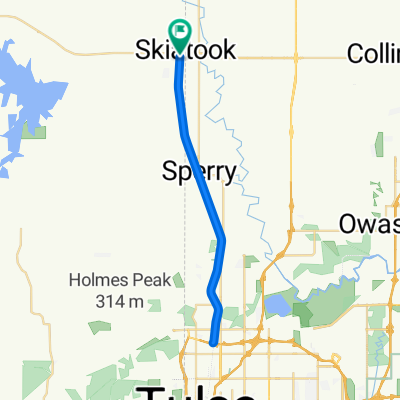
Skiatook/Avant
A cycling route starting in Skiatook, Oklahoma, United States.
Overview
About this route
- -:--
- Duration
- 91.1 km
- Distance
- 410 m
- Ascent
- 416 m
- Descent
- ---
- Avg. speed
- ---
- Max. altitude

Route quality
Waytypes & surfaces along the route
Waytypes
Road
73.8 km
(81 %)
Quiet road
14.6 km
(16 %)
Surfaces
Paved
35.5 km
(39 %)
Unpaved
30.1 km
(33 %)
Paved (undefined)
33.7 km
(37 %)
Gravel
30.1 km
(33 %)
Continue with Bikemap
Use, edit, or download this cycling route
You would like to ride Skiatook/Avant or customize it for your own trip? Here is what you can do with this Bikemap route:
Free features
- Save this route as favorite or in collections
- Copy & plan your own version of this route
- Split it into stages to create a multi-day tour
- Sync your route with Garmin or Wahoo
Premium features
Free trial for 3 days, or one-time payment. More about Bikemap Premium.
- Navigate this route on iOS & Android
- Export a GPX / KML file of this route
- Create your custom printout (try it for free)
- Download this route for offline navigation
Discover more Premium features.
Get Bikemap PremiumFrom our community
Other popular routes starting in Skiatook
 15 miles
- Distance
- 24.1 km
- Ascent
- 158 m
- Descent
- 170 m
- Location
- Skiatook, Oklahoma, United States
 110 N Broadway St, Skiatook to 9610 S 90th E Ave, Tulsa
- Distance
- 50.8 km
- Ascent
- 233 m
- Descent
- 211 m
- Location
- Skiatook, Oklahoma, United States
 to avant
- Distance
- 53.4 km
- Ascent
- 324 m
- Descent
- 327 m
- Location
- Skiatook, Oklahoma, United States
 Skiatook/Avant
- Distance
- 91.1 km
- Ascent
- 410 m
- Descent
- 416 m
- Location
- Skiatook, Oklahoma, United States
 Osage Prairie Trail, Skiatook to Skiatook
- Distance
- 39.5 km
- Ascent
- 134 m
- Descent
- 134 m
- Location
- Skiatook, Oklahoma, United States
Open it in the app