

Moor-Köche-Tour - Hike & Bike
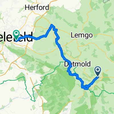
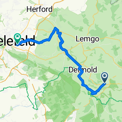
A cycling route starting in Bad Meinberg, North Rhine-Westphalia, Germany.
Overview
About this route
Morning: Hiking on the most beautiful stage of the Hermannshöhen - between Holzhausen-Externsteine and Leopoldstal. At noon: Dining at one of the 11 moor chefs. Afternoon: From there, return by rental bike to the ADFC station Bad Meinberg. Daily program from 10 people includes: 1 consumption voucher €10 1 bike transport 1 rental bike Price per person €19.80 More information: Tourist Information Parkstraße 2 32808 Horn-Bad Meinberg Phone: 05234-98903 www.externsteine.de
- -:--
- Duration
- 36.4 km
- Distance
- 569 m
- Ascent
- 572 m
- Descent
- ---
- Avg. speed
- ---
- Max. altitude
Continue with Bikemap
Use, edit, or download this cycling route
You would like to ride Moor-Köche-Tour - Hike & Bike or customize it for your own trip? Here is what you can do with this Bikemap route:
Free features
- Save this route as favorite or in collections
- Copy & plan your own version of this route
- Sync your route with Garmin or Wahoo
Premium features
Free trial for 3 days, or one-time payment. More about Bikemap Premium.
- Navigate this route on iOS & Android
- Export a GPX / KML file of this route
- Create your custom printout (try it for free)
- Download this route for offline navigation
Discover more Premium features.
Get Bikemap PremiumFrom our community
Other popular routes starting in Bad Meinberg
 8a Horn-Bad Meinberg-Hermann- Bielefeld
- Distance
- 62.1 km
- Ascent
- 625 m
- Descent
- 727 m
- Location
- Bad Meinberg, North Rhine-Westphalia, Germany
 Lippe Highlights
- Distance
- 43.7 km
- Ascent
- 594 m
- Descent
- 603 m
- Location
- Bad Meinberg, North Rhine-Westphalia, Germany
 Bad Meinberg-Paderborn
- Distance
- 34.9 km
- Ascent
- 146 m
- Descent
- 252 m
- Location
- Bad Meinberg, North Rhine-Westphalia, Germany
 E 4 Kleppergarten 3, Horn-Bad Meinberg nach Grubestraße 16, Höxter
- Distance
- 49.9 km
- Ascent
- 27 m
- Descent
- 50 m
- Location
- Bad Meinberg, North Rhine-Westphalia, Germany
 Große Lipperlandtour
- Distance
- 45.4 km
- Ascent
- 433 m
- Descent
- 432 m
- Location
- Bad Meinberg, North Rhine-Westphalia, Germany
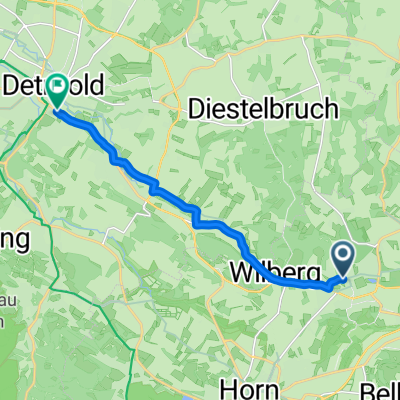 Von Horn-Bad Meinberg bis Detmold
- Distance
- 9.2 km
- Ascent
- 59 m
- Descent
- 137 m
- Location
- Bad Meinberg, North Rhine-Westphalia, Germany
 Moor-Köche-Tour - Hike & Bike
- Distance
- 36.4 km
- Ascent
- 569 m
- Descent
- 572 m
- Location
- Bad Meinberg, North Rhine-Westphalia, Germany
 8b Horn-Bad Meinberg - Bielefeld
- Distance
- 58.1 km
- Ascent
- 334 m
- Descent
- 436 m
- Location
- Bad Meinberg, North Rhine-Westphalia, Germany
Open it in the app