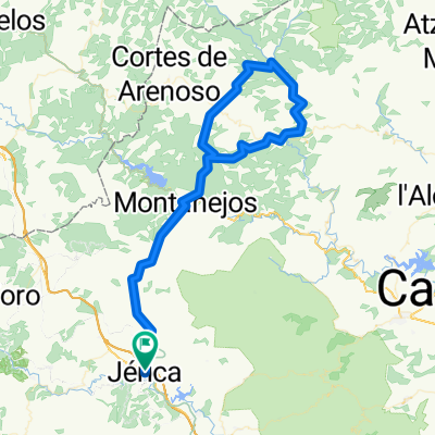
Jérica-Paisajes del Palancia
A cycling route starting in Jérica, Valencia, Spain.
Overview
About this route
Ruta siguiendo el Río Palancia. Salida desde el Hardacho Bike Center hacia Viver por Carril Bicil. Bajada al paraje de El Sargal entrando siguiendo el Río Palancia. Subida de nuevo a la Carretera de Viver y bajada de nuevo hacia Jérica. Bajada a la Vuelta de la Hoz, salida de la misma por Molino de la Morería hacia la Vía Verde de Ojos Negros. Por la Vía Verde hasta STOP en casilla de Guardagujas. Tomamos carretera en dirección a Navajas (CV213) Entrada en Navajas y bajada al Salto de la Novia. Regreso por Navajas pasando por Plaza del Olmo (árbol monumental de España 2019). Por camino junto al Río hasta tomar carretera de Gaibiel (CV213), al llegar a cruce, giro a la izquierda por CV212 dirección Jérica. Cruce, giro a la izquierda dirección Jérica por CV212.
- -:--
- Duration
- 34.7 km
- Distance
- 357 m
- Ascent
- 357 m
- Descent
- ---
- Avg. speed
- ---
- Max. altitude
Route quality
Waytypes & surfaces along the route
Waytypes
Road
14.2 km
(41 %)
Quiet road
7.4 km
(21 %)
Surfaces
Paved
13.9 km
(40 %)
Unpaved
1 km
(3 %)
Paved (undefined)
6.9 km
(20 %)
Asphalt
5.7 km
(17 %)
Continue with Bikemap
Use, edit, or download this cycling route
You would like to ride Jérica-Paisajes del Palancia or customize it for your own trip? Here is what you can do with this Bikemap route:
Free features
- Save this route as favorite or in collections
- Copy & plan your own version of this route
- Sync your route with Garmin or Wahoo
Premium features
Free trial for 3 days, or one-time payment. More about Bikemap Premium.
- Navigate this route on iOS & Android
- Export a GPX / KML file of this route
- Create your custom printout (try it for free)
- Download this route for offline navigation
Discover more Premium features.
Get Bikemap PremiumFrom our community
Other popular routes starting in Jérica
 PUERTOMINGALVO
- Distance
- 129.4 km
- Ascent
- 4,206 m
- Descent
- 4,138 m
- Location
- Jérica, Valencia, Spain
 ESP 034: Via Verde Ojos Negros (Südabschnitt- 3. Teil)
- Distance
- 82.1 km
- Ascent
- 826 m
- Descent
- 827 m
- Location
- Jérica, Valencia, Spain
 ESP 033: Via Verde Ojos Negros (Südabschnitt- 2. Teil)
- Distance
- 87.7 km
- Ascent
- 702 m
- Descent
- 702 m
- Location
- Jérica, Valencia, Spain
 Jérica-Montanejos-Villahermosa-Montanejos-Jérica
- Distance
- 112.6 km
- Ascent
- 3,534 m
- Descent
- 3,437 m
- Location
- Jérica, Valencia, Spain
 Paisajes del Río Palancia
- Distance
- 29.1 km
- Ascent
- 407 m
- Descent
- 397 m
- Location
- Jérica, Valencia, Spain
 Caudiel, Alcabaira, Maspalomas, Cerdaña, Fuensanta
- Distance
- 24 km
- Ascent
- 646 m
- Descent
- 647 m
- Location
- Jérica, Valencia, Spain
 Jérica-Paisajes del Palancia
- Distance
- 34.7 km
- Ascent
- 357 m
- Descent
- 357 m
- Location
- Jérica, Valencia, Spain
 dave77: Caudiel - Sagunto (Via Verde Ojos Negros)
- Distance
- 54.9 km
- Ascent
- 74 m
- Descent
- 645 m
- Location
- Jérica, Valencia, Spain
Open it in the app


