

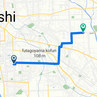
早川コース
A cycling route starting in Maebashi, Gunma, Japan.
Overview
About this route
- -:--
- Duration
- 73.6 km
- Distance
- 252 m
- Ascent
- 252 m
- Descent
- ---
- Avg. speed
- ---
- Max. altitude

Continue with Bikemap
Use, edit, or download this cycling route
You would like to ride 早川コース or customize it for your own trip? Here is what you can do with this Bikemap route:
Free features
- Save this route as favorite or in collections
- Copy & plan your own version of this route
- Sync your route with Garmin or Wahoo
Premium features
Free trial for 3 days, or one-time payment. More about Bikemap Premium.
- Navigate this route on iOS & Android
- Export a GPX / KML file of this route
- Create your custom printout (try it for free)
- Download this route for offline navigation
Discover more Premium features.
Get Bikemap PremiumFrom our community
Other popular routes starting in Maebashi
 maebashi to ikaho
- Distance
- 23.2 km
- Ascent
- 738 m
- Descent
- 82 m
- Location
- Maebashi, Gunma, Japan
 赤城南麓走り満喫コース
- Distance
- 73 km
- Ascent
- 1,136 m
- Descent
- 1,134 m
- Location
- Maebashi, Gunma, Japan
 Maebashi to Sakura Riverside Park, Kumagaya
- Distance
- 56.5 km
- Ascent
- 66 m
- Descent
- 157 m
- Location
- Maebashi, Gunma, Japan
 gunma
gunma- Distance
- 109.6 km
- Ascent
- 2,096 m
- Descent
- 2,094 m
- Location
- Maebashi, Gunma, Japan
 1-chōme, Maebashi to FVGH+Q8, Takasaki
- Distance
- 37.7 km
- Ascent
- 1,771 m
- Descent
- 509 m
- Location
- Maebashi, Gunma, Japan
 市街地~敷島周遊コース
- Distance
- 11.9 km
- Ascent
- 55 m
- Descent
- 56 m
- Location
- Maebashi, Gunma, Japan
 19-10, Wakamiyacho 4-Chōme, Maebashi to 1381, Koyaharamachi, Maebashi
- Distance
- 40 km
- Ascent
- 0 m
- Descent
- 36 m
- Location
- Maebashi, Gunma, Japan
 1-chōme 2, Maebashi to Maebashi
- Distance
- 4.2 km
- Ascent
- 17 m
- Descent
- 23 m
- Location
- Maebashi, Gunma, Japan
Open it in the app