

日本遺産・加賀四湯いでゆルート
A cycling route starting in Komatsu, Ishikawa, Japan.
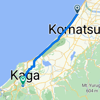
Overview
About this route
- -:--
- Duration
- 79.9 km
- Distance
- 638 m
- Ascent
- 641 m
- Descent
- ---
- Avg. speed
- ---
- Max. altitude

Continue with Bikemap
Use, edit, or download this cycling route
You would like to ride 日本遺産・加賀四湯いでゆルート or customize it for your own trip? Here is what you can do with this Bikemap route:
Free features
- Save this route as favorite or in collections
- Copy & plan your own version of this route
- Sync your route with Garmin or Wahoo
Premium features
Free trial for 3 days, or one-time payment. More about Bikemap Premium.
- Navigate this route on iOS & Android
- Export a GPX / KML file of this route
- Create your custom printout (try it for free)
- Download this route for offline navigation
Discover more Premium features.
Get Bikemap PremiumFrom our community
Other popular routes starting in Komatsu
 Ohamamachi Ku, Nomi to Daishojishitayashikimachi, Kaga
- Distance
- 24.2 km
- Ascent
- 134 m
- Descent
- 134 m
- Location
- Komatsu, Ishikawa, Japan
 lkh;ll
- Distance
- 61.1 km
- Ascent
- 1,199 m
- Descent
- 1,035 m
- Location
- Komatsu, Ishikawa, Japan
 De 141, Nishicho, Komatsu a 141, Nishicho, Komatsu
- Distance
- 48.2 km
- Ascent
- 423 m
- Descent
- 424 m
- Location
- Komatsu, Ishikawa, Japan

 Takigahara - Ataka Route (Komatsu-Kaga Bike Path)
- Distance
- 22.2 km
- Ascent
- 27 m
- Descent
- 21 m
- Location
- Komatsu, Ishikawa, Japan
 Yamashiro route
- Distance
- 1.1 km
- Ascent
- 0 m
- Descent
- 4 m
- Location
- Komatsu, Ishikawa, Japan
 Recovered Route
- Distance
- 58.8 km
- Ascent
- 0 m
- Descent
- 3 m
- Location
- Komatsu, Ishikawa, Japan
 lkashla
- Distance
- 59.9 km
- Ascent
- 1,114 m
- Descent
- 985 m
- Location
- Komatsu, Ishikawa, Japan
Open it in the app