

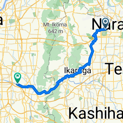
九条ルート(C4)
A cycling route starting in Nara, Nara, Japan.
Overview
About this route
- -:--
- Duration
- 4.8 km
- Distance
- 9 m
- Ascent
- 22 m
- Descent
- ---
- Avg. speed
- ---
- Max. altitude

Route quality
Waytypes & surfaces along the route
Waytypes
Road
2.5 km
(52 %)
Pedestrian area
0.6 km
(12 %)
Surfaces
Paved
1.1 km
(22 %)
Paved (undefined)
0.6 km
(13 %)
Asphalt
0.4 km
(9 %)
Undefined
3.7 km
(78 %)
Continue with Bikemap
Use, edit, or download this cycling route
You would like to ride 九条ルート(C4) or customize it for your own trip? Here is what you can do with this Bikemap route:
Free features
- Save this route as favorite or in collections
- Copy & plan your own version of this route
- Sync your route with Garmin or Wahoo
Premium features
Free trial for 3 days, or one-time payment. More about Bikemap Premium.
- Navigate this route on iOS & Android
- Export a GPX / KML file of this route
- Create your custom printout (try it for free)
- Download this route for offline navigation
Discover more Premium features.
Get Bikemap PremiumFrom our community
Other popular routes starting in Nara
 モバイル グランフォンド 柳生、大和青垣高原、宇陀、上ツ道
- Distance
- 93.1 km
- Ascent
- 1,672 m
- Descent
- 1,672 m
- Location
- Nara, Nara, Japan
 Nara - Kashihara
- Distance
- 36.4 km
- Ascent
- 292 m
- Descent
- 360 m
- Location
- Nara, Nara, Japan
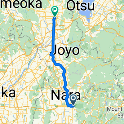
 兜台4丁目, 木津川市へ兜台4丁目, 木津川市
- Distance
- 16.4 km
- Ascent
- 146 m
- Descent
- 140 m
- Location
- Nara, Nara, Japan
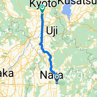
 Nara to Kyoto
- Distance
- 52.8 km
- Ascent
- 294 m
- Descent
- 400 m
- Location
- Nara, Nara, Japan
 兜台4丁目, 木津川市へ兜台4丁目, 木津川市
- Distance
- 16.8 km
- Ascent
- 110 m
- Descent
- 109 m
- Location
- Nara, Nara, Japan
 nara to kyoto
- Distance
- 45.3 km
- Ascent
- 81 m
- Descent
- 136 m
- Location
- Nara, Nara, Japan
 Nara to Osaka
- Distance
- 38.3 km
- Ascent
- 272 m
- Descent
- 325 m
- Location
- Nara, Nara, Japan
 モバイル グランフォンド in 奈良・吉野 柳生、大和青垣高原、宇陀、吉野、明日香、上ツ道T2~T1~T5~C1
- Distance
- 132.6 km
- Ascent
- 3,024 m
- Descent
- 3,025 m
- Location
- Nara, Nara, Japan
Open it in the app