Day 4 - 25 July
- 82.6 km
- 1,286 m
- 1,230 m
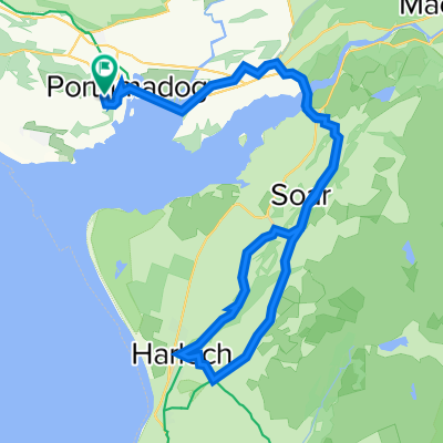
- Porthmadog, Wales, United Kingdom
A cycling route starting in Porthmadog, Wales, United Kingdom.
Overview
START; Portmadog | LOO STOP; Harlech @ 10m
LOO STOP; Tal-y-Bont @16m | AM STOP; Barmouth @ 21m
LUNCH; Degallau @ 30m | BIG climb to 1325ft
Summit 1 @4miles to 258mt / 845 ft
Road Crossing at 223 mt / 731 ft
Summit 2 @ 7.5miles on 405 mt / 1329 ft
PM stop; Machynlleth 46m | LOO s.; Tal-y-Bont 56m
Final Climb; sea level to 395 ft - 120mt
FINISH - ABERYSTWYTH @ 65 miles / 107 km
created this 5 years ago
Route quality
Cycleway
39.5 km
(37 %)
Quiet road
31 km
(29 %)
Paved
75.9 km
(71 %)
Unpaved
10.7 km
(10 %)
Asphalt
72.7 km
(68 %)
Gravel
8.5 km
(8 %)
Route highlights
ROUTE CHANGE
LOO STOP, HARLECH STATION, TOILETS UNDER CASTLE @ 10m
ROUTE ON NARROW ROAD
AM STOP, TAL-Y-BONT, CAR PARK TOILETS @ 16 MILES
ROUTE SWITCHES PAVEMENTS
TURN RIGHT - STEEP ROAD
LOO STOP, BARMOUTH QUAY TOILETS AT 21 m
DOLGELLAU LUNCH STOP AT 30 miles - 10mt/
START STEEP CLIMB 1; 4 miles TO 230mt / 750 ft
SUMMIT #1 after 4 miles at 258mt / 845 ft
DISMOUNT TO CROSS MAIN ROAD at 223mt / 731 ft
START 2 CLIMB TO 223mt / 731 ft
SUMMIT #2 at 3 miles 405mt / 1329 ft 15m DESCENT TO PM STOP
DANGER STEEP DESCENT
SHARP TURN LEFT
KEEP LEFT
KEEP LEFT
RIDE ON PAVEMENT
RIDE ON PAVEMENT
PM STOP; MACHYNLLETH, TOWN CARPARK - TOILETS AT 46 miles
RIDE SWITCHES PAVEMENTS
ROUTE SWITCHES PAVEMENTS
!!! BACK ON ROAD
RIDE ON PAVEMENTS
RIDE ON ROAD
LOO STOP; TAL-Y-BONT pub toilets ay 55m / 91km
ROUTE SWITCHES PAYMENTS
ROUTE BACK ON ROAD
BIKE BRIDGE
LOO STOP, CLARACH BEACH at 60m / 100km
START CLIMB AT SEA LEVEL TO
MID POINT CLIMB AT 215 ft / 65mt
SUMMIT AT 395 ft / 120mt
REGROUP - GILL AT FRONT TO FINISH
FINISH ; PROMENADE
PREMIER INN CARPARK
Continue with Bikemap
You would like to ride Cymru North Coast - Day 4.zz or customize it for your own trip? Here is what you can do with this Bikemap route:
Free trial for 3 days, or one-time payment. More about Bikemap Premium.
Discover more Premium features.
Get Bikemap PremiumFrom our community
Open it in the app