

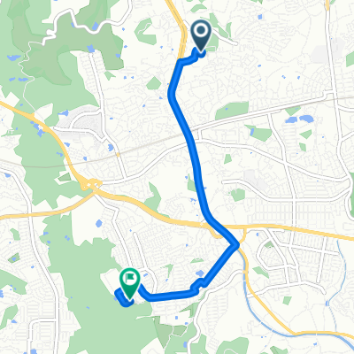
信貴山ルート(T11)
A cycling route starting in Ikoma, Nara, Japan.
Overview
About this route
- -:--
- Duration
- 9.5 km
- Distance
- 400 m
- Ascent
- 383 m
- Descent
- ---
- Avg. speed
- ---
- Max. altitude

Route quality
Waytypes & surfaces along the route
Waytypes
Road
8.2 km
(86 %)
Quiet road
0.5 km
(5 %)
Undefined
0.9 km
(9 %)
Surfaces
Paved
8 km
(84 %)
Paved (undefined)
8 km
(84 %)
Undefined
1.5 km
(16 %)
Continue with Bikemap
Use, edit, or download this cycling route
You would like to ride 信貴山ルート(T11) or customize it for your own trip? Here is what you can do with this Bikemap route:
Free features
- Save this route as favorite or in collections
- Copy & plan your own version of this route
- Sync your route with Garmin or Wahoo
Premium features
Free trial for 3 days, or one-time payment. More about Bikemap Premium.
- Navigate this route on iOS & Android
- Export a GPX / KML file of this route
- Create your custom printout (try it for free)
- Download this route for offline navigation
Discover more Premium features.
Get Bikemap PremiumFrom our community
Other popular routes starting in Ikoma
 Alternate way to C7
- Distance
- 40.6 km
- Ascent
- 122 m
- Descent
- 112 m
- Location
- Ikoma, Nara, Japan
 Heart Loop
- Distance
- 118.6 km
- Ascent
- 592 m
- Descent
- 624 m
- Location
- Ikoma, Nara, Japan
 Sporty route in Nara-Shi
- Distance
- 4.4 km
- Ascent
- 97 m
- Descent
- 49 m
- Location
- Ikoma, Nara, Japan
 学園大和町5丁目85, 奈良市 to 学園大和町5丁目151, 奈良市
- Distance
- 80.3 km
- Ascent
- 586 m
- Descent
- 586 m
- Location
- Ikoma, Nara, Japan
 UR to Wazuka
- Distance
- 51.8 km
- Ascent
- 539 m
- Descent
- 542 m
- Location
- Ikoma, Nara, Japan
 Nara-Yamato-koriyama Route
- Distance
- 14.6 km
- Ascent
- 80 m
- Descent
- 141 m
- Location
- Ikoma, Nara, Japan
 矢田山ライド
- Distance
- 9.1 km
- Ascent
- 213 m
- Descent
- 323 m
- Location
- Ikoma, Nara, Japan
 Nara-Yamato-koriyama Route
- Distance
- 42.2 km
- Ascent
- 107 m
- Descent
- 167 m
- Location
- Ikoma, Nara, Japan
Open it in the app