

補助幹線ルート(C22)
A cycling route starting in Tawaramoto, Nara, Japan.
Overview
About this route
- -:--
- Duration
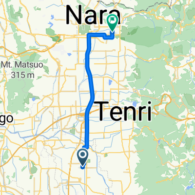
- 7.1 km
- Distance
- 23 m
- Ascent
- 13 m
- Descent
- ---
- Avg. speed
- ---
- Max. altitude

Route quality
Waytypes & surfaces along the route
Waytypes
Cycleway
5.9 km
(83 %)
Quiet road
0.4 km
(6 %)
Undefined
0.8 km
(11 %)
Continue with Bikemap
Use, edit, or download this cycling route
You would like to ride 補助幹線ルート(C22) or customize it for your own trip? Here is what you can do with this Bikemap route:
Free features
- Save this route as favorite or in collections
- Copy & plan your own version of this route
- Sync your route with Garmin or Wahoo
Premium features
Free trial for 3 days, or one-time payment. More about Bikemap Premium.
- Navigate this route on iOS & Android
- Export a GPX / KML file of this route
- Create your custom printout (try it for free)
- Download this route for offline navigation
Discover more Premium features.
Get Bikemap PremiumFrom our community
Other popular routes starting in Tawaramoto
 9丁目 8, 斑鳩町 to 9丁目 8, 斑鳩町
- Distance
- 19.7 km
- Ascent
- 148 m
- Descent
- 169 m
- Location
- Tawaramoto, Nara, Japan
 12
12- Distance
- 6.7 km
- Ascent
- 73 m
- Descent
- 68 m
- Location
- Tawaramoto, Nara, Japan
 1丁目, 香芝市 to 5丁目 13, 広陵町
- Distance
- 3.1 km
- Ascent
- 23 m
- Descent
- 11 m
- Location
- Tawaramoto, Nara, Japan
 Extensive Tuesday Track In Tawaramoto-Cho, Shiki-Gun
- Distance
- 18.2 km
- Ascent
- 90 m
- Descent
- 41 m
- Location
- Tawaramoto, Nara, Japan
 Tawaramoto ES-Higashi ES
- Distance
- 2.9 km
- Ascent
- 15 m
- Descent
- 8 m
- Location
- Tawaramoto, Nara, Japan
 12-16, Hirosedai 3-Chōme, Kawai, Kitakatsuragi-Gun to Fujii 3-Chōme, Oji, Kitakatsuragi-Gun
- Distance
- 6 km
- Ascent
- 232 m
- Descent
- 29 m
- Location
- Tawaramoto, Nara, Japan
 天理〜香芝
天理〜香芝- Distance
- 17.5 km
- Ascent
- 71 m
- Descent
- 64 m
- Location
- Tawaramoto, Nara, Japan
 奈良法隆寺-京都東寺
- Distance
- 62.1 km
- Ascent
- 340 m
- Descent
- 365 m
- Location
- Tawaramoto, Nara, Japan
Open it in the app