

補助幹線ルート(C25)
A cycling route starting in Kashihara-shi, Nara, Japan.
Overview
About this route
- -:--
- Duration
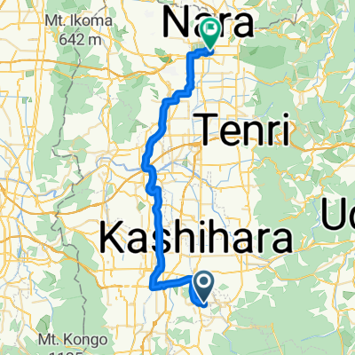
- 4.2 km
- Distance
- 28 m
- Ascent
- 4 m
- Descent
- ---
- Avg. speed
- ---
- Max. altitude

Route quality
Waytypes & surfaces along the route
Waytypes
Quiet road
4.2 km
(100 %)
Continue with Bikemap
Use, edit, or download this cycling route
You would like to ride 補助幹線ルート(C25) or customize it for your own trip? Here is what you can do with this Bikemap route:
Free features
- Save this route as favorite or in collections
- Copy & plan your own version of this route
- Sync your route with Garmin or Wahoo
Premium features
Free trial for 3 days, or one-time payment. More about Bikemap Premium.
- Navigate this route on iOS & Android
- Export a GPX / KML file of this route
- Create your custom printout (try it for free)
- Download this route for offline navigation
Discover more Premium features.
Get Bikemap PremiumFrom our community
Other popular routes starting in Kashihara-shi
 Day 599
- Distance
- 37.4 km
- Ascent
- 420 m
- Descent
- 280 m
- Location
- Kashihara-shi, Nara, Japan
 591−1, 橿原市 to 奈良市
- Distance
- 36.3 km
- Ascent
- 203 m
- Descent
- 224 m
- Location
- Kashihara-shi, Nara, Japan
 690-4, Kuzumotocho, Kashihara to 861-2, Akamecho Nagasaka, Nabari
- Distance
- 32 km
- Ascent
- 614 m
- Descent
- 323 m
- Location
- Kashihara-shi, Nara, Japan
 橿原ー下北山村
- Distance
- 116 km
- Ascent
- 1,971 m
- Descent
- 1,852 m
- Location
- Kashihara-shi, Nara, Japan
 橿原神宮→上北山→尾鷲
- Distance
- 83.5 km
- Ascent
- 3,599 m
- Descent
- 3,671 m
- Location
- Kashihara-shi, Nara, Japan
 自転車九州旅
- Distance
- 860.2 km
- Ascent
- 1,286 m
- Descent
- 1,332 m
- Location
- Kashihara-shi, Nara, Japan
 Nara to Wakayama
- Distance
- 82.7 km
- Ascent
- 273 m
- Descent
- 327 m
- Location
- Kashihara-shi, Nara, Japan
 Recovered Route
- Distance
- 17.4 km
- Ascent
- 78 m
- Descent
- 100 m
- Location
- Kashihara-shi, Nara, Japan
Open it in the app