

一般県道遠賀宗像自転車道線(ひびき灘自転車道線)
A cycling route starting in Nakama, Fukuoka, Japan.
Overview
About this route
- -:--
- Duration
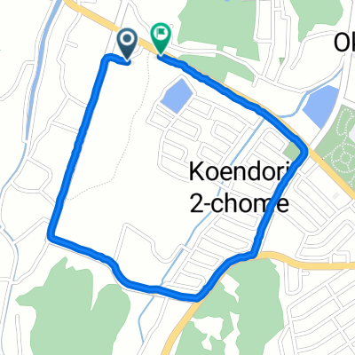
- 28.8 km
- Distance
- 108 m
- Ascent
- 98 m
- Descent
- ---
- Avg. speed
- ---
- Max. altitude

Continue with Bikemap
Use, edit, or download this cycling route
You would like to ride 一般県道遠賀宗像自転車道線(ひびき灘自転車道線) or customize it for your own trip? Here is what you can do with this Bikemap route:
Free features
- Save this route as favorite or in collections
- Copy & plan your own version of this route
- Sync your route with Garmin or Wahoo
Premium features
Free trial for 3 days, or one-time payment. More about Bikemap Premium.
- Navigate this route on iOS & Android
- Export a GPX / KML file of this route
- Create your custom printout (try it for free)
- Download this route for offline navigation
Discover more Premium features.
Get Bikemap PremiumFrom our community
Other popular routes starting in Nakama
 若松遠回り退勤ライド
- Distance
- 22.3 km
- Ascent
- 66 m
- Descent
- 71 m
- Location
- Nakama, Fukuoka, Japan
 2-chōme 4, Okagaki to 3-chōme 10, Fukuoka
- Distance
- 56 km
- Ascent
- 266 m
- Descent
- 305 m
- Location
- Nakama, Fukuoka, Japan
 680−8 まで岡垣町
- Distance
- 2.6 km
- Ascent
- 84 m
- Descent
- 112 m
- Location
- Nakama, Fukuoka, Japan
 Tobata to Mizumaki route
- Distance
- 11.6 km
- Ascent
- 0 m
- Descent
- 0 m
- Location
- Nakama, Fukuoka, Japan
 3, Kurosaki 5-Chōme, Yahatanishi-Ku, Kitakyushu-Shi to 670-18, Hara, Okagaki-Machi, Onga-Gun
- Distance
- 22.2 km
- Ascent
- 0 m
- Descent
- 11 m
- Location
- Nakama, Fukuoka, Japan
 Sporty route in Munakata-Shi
- Distance
- 27.9 km
- Ascent
- 0 m
- Descent
- 7 m
- Location
- Nakama, Fukuoka, Japan
 遠賀自転車道40キロコース
- Distance
- 37.3 km
- Ascent
- 44 m
- Descent
- 45 m
- Location
- Nakama, Fukuoka, Japan
 20キロサイクリングコース
- Distance
- 20 km
- Ascent
- 85 m
- Descent
- 83 m
- Location
- Nakama, Fukuoka, Japan
Open it in the app