

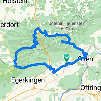
Trimbach; Mahren; Dulliken; Wangen b. Olten
A cycling route starting in Wangen, Canton of Solothurn, Switzerland.
Overview
About this route
- 1 h 12 min
- Duration
- 23.4 km
- Distance
- 441 m
- Ascent
- 433 m
- Descent
- 19.5 km/h
- Avg. speed
- ---
- Max. altitude

Route photos


Route quality
Waytypes & surfaces along the route
Waytypes
Quiet road
9.8 km
(42 %)
Track
6.1 km
(26 %)
Surfaces
Paved
11.7 km
(50 %)
Unpaved
5.6 km
(24 %)
Asphalt
11.7 km
(50 %)
Gravel
4.9 km
(21 %)
Continue with Bikemap
Use, edit, or download this cycling route
You would like to ride Trimbach; Mahren; Dulliken; Wangen b. Olten or customize it for your own trip? Here is what you can do with this Bikemap route:
Free features
- Save this route as favorite or in collections
- Copy & plan your own version of this route
- Sync your route with Garmin or Wahoo
Premium features
Free trial for 3 days, or one-time payment. More about Bikemap Premium.
- Navigate this route on iOS & Android
- Export a GPX / KML file of this route
- Create your custom printout (try it for free)
- Download this route for offline navigation
Discover more Premium features.
Get Bikemap PremiumFrom our community
Other popular routes starting in Wangen
 Solothurn - Wangen bei Olten
- Distance
- 73.3 km
- Ascent
- 435 m
- Descent
- 388 m
- Location
- Wangen, Canton of Solothurn, Switzerland
 Allerheiligen, Holderbank, Oberbuchsiten, Wangen
- Distance
- 18.7 km
- Ascent
- 764 m
- Descent
- 731 m
- Location
- Wangen, Canton of Solothurn, Switzerland
 Dorfstrasse, Wangen b. Olten až Dorfstrasse, Wangen b. Olten
- Distance
- 24.6 km
- Ascent
- 210 m
- Descent
- 196 m
- Location
- Wangen, Canton of Solothurn, Switzerland
 Langenbruck - Chesselberg
- Distance
- 39.9 km
- Ascent
- 990 m
- Descent
- 990 m
- Location
- Wangen, Canton of Solothurn, Switzerland
 Schmiedenmatt Tannmatt
- Distance
- 78 km
- Ascent
- 1,190 m
- Descent
- 1,192 m
- Location
- Wangen, Canton of Solothurn, Switzerland
 Santel Kapelle
- Distance
- 6.2 km
- Ascent
- 120 m
- Descent
- 42 m
- Location
- Wangen, Canton of Solothurn, Switzerland
 Allerheiligen Wangen
- Distance
- 25.5 km
- Ascent
- 777 m
- Descent
- 729 m
- Location
- Wangen, Canton of Solothurn, Switzerland
 Entspannende Route um Wangen b. Olten
- Distance
- 23.8 km
- Ascent
- 427 m
- Descent
- 419 m
- Location
- Wangen, Canton of Solothurn, Switzerland
Open it in the app