
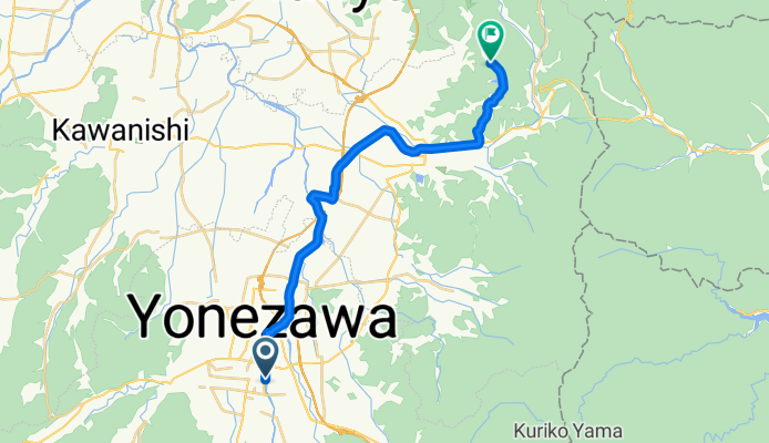
一般県道米沢県南公園自転車道線(置賜自転車道)
A cycling route starting in Yonezawa, Yamagata, Japan.
Overview
About this route
- -:--
- Duration
- 23.5 km
- Distance
- 153 m
- Ascent
- 109 m
- Descent
- ---
- Avg. speed
- ---
- Max. altitude

Continue with Bikemap
Use, edit, or download this cycling route
You would like to ride 一般県道米沢県南公園自転車道線(置賜自転車道) or customize it for your own trip? Here is what you can do with this Bikemap route:
Free features
- Save this route as favorite or in collections
- Copy & plan your own version of this route
- Sync your route with Garmin or Wahoo
Premium features
Free trial for 3 days, or one-time payment. More about Bikemap Premium.
- Navigate this route on iOS & Android
- Export a GPX / KML file of this route
- Create your custom printout (try it for free)
- Download this route for offline navigation
Discover more Premium features.
Get Bikemap PremiumFrom our community
Other popular routes starting in Yonezawa
 Yamagata explorer pt2b : Yonezawa - Arato
- Distance
- 62.6 km
- Ascent
- 436 m
- Descent
- 504 m
- Location
- Yonezawa, Yamagata, Japan
 八幡原5丁目3948-9, 米沢市 to 東2丁目3-13, 米沢市
- Distance
- 4.7 km
- Ascent
- 48 m
- Descent
- 71 m
- Location
- Yonezawa, Yamagata, Japan
 県道1号, Yonezawa-Shi to 971-2, Kawai, Yonezawa-Shi
- Distance
- 1.8 km
- Ascent
- 3 m
- Descent
- 7 m
- Location
- Yonezawa, Yamagata, Japan
 4-chōme 1, Yonezawa to 3-chōme 6, Kaminoyama
- Distance
- 34.6 km
- Ascent
- 122 m
- Descent
- 172 m
- Location
- Yonezawa, Yamagata, Japan
 東2丁目3-13, 米沢市 to 八幡原, 米沢市
- Distance
- 4.7 km
- Ascent
- 36 m
- Descent
- 20 m
- Location
- Yonezawa, Yamagata, Japan
 中央1丁目, 米沢市へ矢来2丁目, 米沢市
- Distance
- 2.4 km
- Ascent
- 3 m
- Descent
- 0 m
- Location
- Yonezawa, Yamagata, Japan
 Yamagata explorer pt1 : Oosawa - Yonezawa
- Distance
- 15.5 km
- Ascent
- 63 m
- Descent
- 283 m
- Location
- Yonezawa, Yamagata, Japan
 09-18-2013_Day15
- Distance
- 72.5 km
- Ascent
- 1,049 m
- Descent
- 1,073 m
- Location
- Yonezawa, Yamagata, Japan
Open it in the app