

主要地方道金沢田鶴浜自転車道(能登海浜自転車道)
A cycling route starting in Kanazawa, Ishikawa, Japan.
Overview
About this route
- -:--
- Duration
- 32.8 km
- Distance
- 104 m
- Ascent
- 117 m
- Descent
- ---
- Avg. speed
- ---
- Max. altitude

Route quality
Waytypes & surfaces along the route
Waytypes
Cycleway
27.9 km
(85 %)
Quiet road
2 km
(6 %)
Surfaces
Paved
30.8 km
(94 %)
Asphalt
30.8 km
(94 %)
Undefined
2 km
(6 %)
Continue with Bikemap
Use, edit, or download this cycling route
You would like to ride 主要地方道金沢田鶴浜自転車道(能登海浜自転車道) or customize it for your own trip? Here is what you can do with this Bikemap route:
Free features
- Save this route as favorite or in collections
- Copy & plan your own version of this route
- Sync your route with Garmin or Wahoo
Premium features
Free trial for 3 days, or one-time payment. More about Bikemap Premium.
- Navigate this route on iOS & Android
- Export a GPX / KML file of this route
- Create your custom printout (try it for free)
- Download this route for offline navigation
Discover more Premium features.
Get Bikemap PremiumFrom our community
Other popular routes starting in Kanazawa
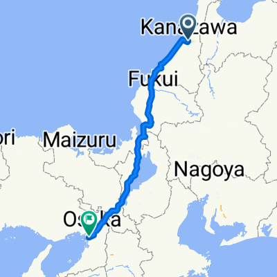 木ノ新保町, 金沢市へ波除3丁目, 大阪市
- Distance
- 324.4 km
- Ascent
- 3,133 m
- Descent
- 3,136 m
- Location
- Kanazawa, Ishikawa, Japan

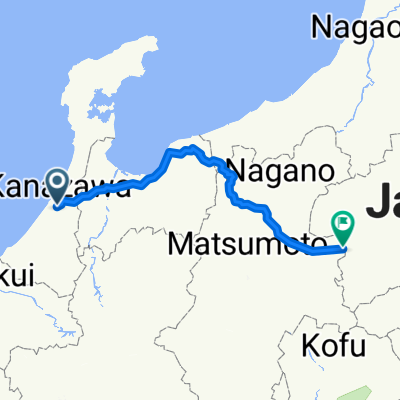 金澤駅往輕井澤駅
- Distance
- 287 km
- Ascent
- 4,703 m
- Descent
- 3,773 m
- Location
- Kanazawa, Ishikawa, Japan
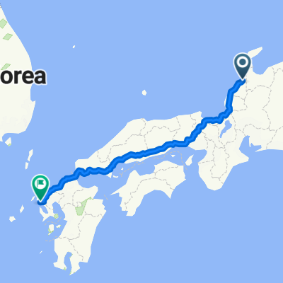 Aug/Sep 2019
- Distance
- 1,046.3 km
- Ascent
- 1,475 m
- Descent
- 1,481 m
- Location
- Kanazawa, Ishikawa, Japan


 2017/3/21
- Distance
- 85.7 km
- Ascent
- 1,710 m
- Descent
- 1,089 m
- Location
- Kanazawa, Ishikawa, Japan
 1丁目, 金沢市 to 南, 金沢市
- Distance
- 5.4 km
- Ascent
- 6 m
- Descent
- 5 m
- Location
- Kanazawa, Ishikawa, Japan
Open it in the app