

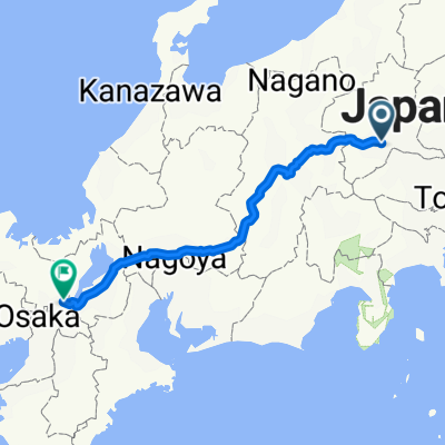
高崎伊勢崎自転車道(一般県道高崎伊勢崎自転車道線)
A cycling route starting in Takasaki, Gunma, Japan.
Overview
About this route
- -:--
- Duration
- 44.4 km
- Distance
- 152 m
- Ascent
- 190 m
- Descent
- ---
- Avg. speed
- ---
- Max. altitude

Route quality
Waytypes & surfaces along the route
Waytypes
Cycleway
36.4 km
(82 %)
Access road
2.7 km
(6 %)
Surfaces
Paved
2.7 km
(6 %)
Asphalt
2.2 km
(5 %)
Paved (undefined)
0.4 km
(1 %)
Undefined
41.7 km
(94 %)
Continue with Bikemap
Use, edit, or download this cycling route
You would like to ride 高崎伊勢崎自転車道(一般県道高崎伊勢崎自転車道線) or customize it for your own trip? Here is what you can do with this Bikemap route:
Free features
- Save this route as favorite or in collections
- Copy & plan your own version of this route
- Sync your route with Garmin or Wahoo
Premium features
Free trial for 3 days, or one-time payment. More about Bikemap Premium.
- Navigate this route on iOS & Android
- Export a GPX / KML file of this route
- Create your custom printout (try it for free)
- Download this route for offline navigation
Discover more Premium features.
Get Bikemap PremiumFrom our community
Other popular routes starting in Takasaki
 Nancy Gray Day 1 Takasaki - Kusatsu
- Distance
- 76.2 km
- Ascent
- 2,038 m
- Descent
- 970 m
- Location
- Takasaki, Gunma, Japan
 Nakasendo_Road_B
- Distance
- 460.7 km
- Ascent
- 7,741 m
- Descent
- 7,800 m
- Location
- Takasaki, Gunma, Japan
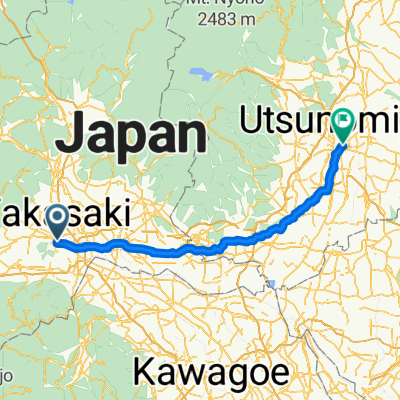 八島町, 高崎市へ川向町, 宇都宮市
- Distance
- 109.4 km
- Ascent
- 469 m
- Descent
- 452 m
- Location
- Takasaki, Gunma, Japan
 早瀬川サイクリングロード
- Distance
- 3.4 km
- Ascent
- 20 m
- Descent
- 4 m
- Location
- Takasaki, Gunma, Japan
 高崎-軽井澤
- Distance
- 46.8 km
- Ascent
- 1,193 m
- Descent
- 348 m
- Location
- Takasaki, Gunma, Japan
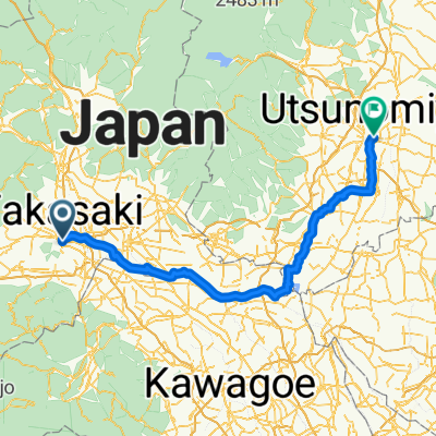 八島町, 高崎市へ川向町, 宇都宮市
- Distance
- 135.6 km
- Ascent
- 356 m
- Descent
- 337 m
- Location
- Takasaki, Gunma, Japan
 2294-30, Yamanamachi, Takasaki to 2294-15, Yamanamachi, Takasaki
- Distance
- 12.1 km
- Ascent
- 95 m
- Descent
- 88 m
- Location
- Takasaki, Gunma, Japan
 1142−1 まで甘楽町
- Distance
- 26.1 km
- Ascent
- 431 m
- Descent
- 274 m
- Location
- Takasaki, Gunma, Japan
Open it in the app