

"Mal kurz in den Tharandter-Wald und zurück"
A cycling route starting in Freiberg, Saxony, Germany.
Overview
About this route
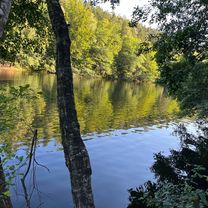
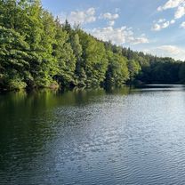
We got a bit lost, that happens when you don't have a map with you. But overall it was fun and it's a good route.
Ride time: about 5 hours Average speed: about 22 km/h
- -:--
- Duration
- 76.8 km
- Distance
- 716 m
- Ascent
- 716 m
- Descent
- ---
- Avg. speed
- ---
- Max. altitude

Route quality
Waytypes & surfaces along the route
Waytypes
Track
19.2 km
(25 %)
Road
15.4 km
(20 %)
Surfaces
Paved
44.5 km
(58 %)
Unpaved
16.1 km
(21 %)
Asphalt
43.8 km
(57 %)
Gravel
10 km
(13 %)
Continue with Bikemap
Use, edit, or download this cycling route
You would like to ride "Mal kurz in den Tharandter-Wald und zurück" or customize it for your own trip? Here is what you can do with this Bikemap route:
Free features
- Save this route as favorite or in collections
- Copy & plan your own version of this route
- Sync your route with Garmin or Wahoo
Premium features
Free trial for 3 days, or one-time payment. More about Bikemap Premium.
- Navigate this route on iOS & Android
- Export a GPX / KML file of this route
- Create your custom printout (try it for free)
- Download this route for offline navigation
Discover more Premium features.
Get Bikemap PremiumFrom our community
Other popular routes starting in Freiberg
 Freiberg-Niederschöna-Mulde-Münzbachtal
- Distance
- 29.4 km
- Ascent
- 366 m
- Descent
- 384 m
- Location
- Freiberg, Saxony, Germany
 MTB Trainingsrunde Rund um Freiberg
- Distance
- 26.5 km
- Ascent
- 283 m
- Descent
- 281 m
- Location
- Freiberg, Saxony, Germany
 morgendliche kurzrunde
- Distance
- 16.5 km
- Ascent
- 176 m
- Descent
- 175 m
- Location
- Freiberg, Saxony, Germany
 FG-DW-202506
- Distance
- 31 km
- Ascent
- 472 m
- Descent
- 543 m
- Location
- Freiberg, Saxony, Germany
 FG-DW-2507
- Distance
- 31.9 km
- Ascent
- 532 m
- Descent
- 602 m
- Location
- Freiberg, Saxony, Germany
 "Mal kurz in den Tharandter-Wald und zurück"
- Distance
- 76.8 km
- Ascent
- 716 m
- Descent
- 716 m
- Location
- Freiberg, Saxony, Germany
 FG-Mulda über Bernhardshöhe 1,5h
- Distance
- 32.1 km
- Ascent
- 372 m
- Descent
- 370 m
- Location
- Freiberg, Saxony, Germany
 Optisch optimierte FG-DD Route
- Distance
- 48.4 km
- Ascent
- 337 m
- Descent
- 636 m
- Location
- Freiberg, Saxony, Germany
Open it in the app