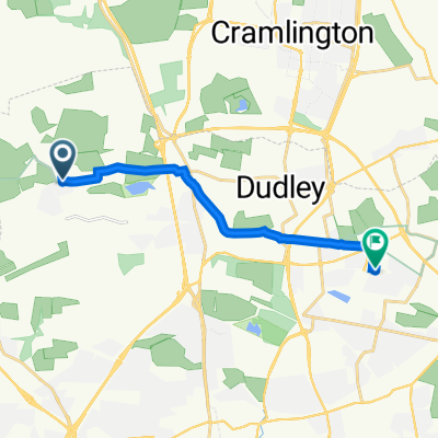
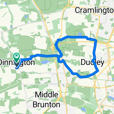
BfCiC Borders Ride June 2010
A cycling route starting in Dinnington, England, United Kingdom.
Overview
About this route
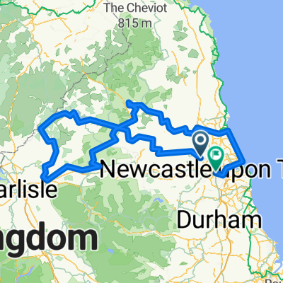
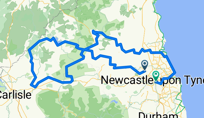
BfCiC Borders Marauders bike ride for Who Cares? Trust, 24th-28th June 2010.
Three and a half days, (approx) 200 miles, nearly 9,000 ft of climb.
Awesome, challenging but beautiful ride.
Elegant figure of eight
- -:--
- Duration
- 317.1 km
- Distance
- 919 m
- Ascent
- 987 m
- Descent
- ---
- Avg. speed
- ---
- Avg. speed
Route quality
Waytypes & surfaces along the route
Waytypes
Quiet road
135.6 km
(43 %)
Road
55.7 km
(18 %)
Surfaces
Paved
64.4 km
(20 %)
Unpaved
29.8 km
(9 %)
Asphalt
60.3 km
(19 %)
Gravel
29.4 km
(9 %)
Route highlights
Points of interest along the route
Point of interest after 22 km
Day 1 Stop, Black Bull, Matfen
Point of interest after 56.8 km
Day 1 & Day 3 Stop, Riverdale Hall, Bellingham
Point of interest after 77.3 km
Kielder Water Dam, Day 2 viewing stop. Lots and lots of biting midges !!
Point of interest after 78.1 km
Day 2 Pit Stop, Kielder Dam, SW corner
Point of interest after 84.2 km
Steep traverse to cross peninsula, Lakeside Walk/ Cycleway
Point of interest after 90.9 km
Day 2 Pit stop,Matthews Linn, Kielder Water
Point of interest after 94.7 km
Akenshaw Burn/ Bloody Bush Road
Point of interest after 100.1 km
High Point, approx 1200ft
Point of interest after 102.2 km
Very steep section of single track
Point of interest after 102.4 km
Scotch Knowe, Scottish Border
Point of interest after 103.1 km
7 miles of downhill forest track.
Point of interest after 108.9 km
Location "Gill"
Point of interest after 115.7 km
Day 2 lunch stop, Baileys Mill
Point of interest after 133.2 km
Bus stop to Carlisle
Point of interest after 136.3 km
Day 3 Bus drop off/ Start: Brampton
Point of interest after 147.1 km
Day 3, Birdoswald pee stop/ Hadrian's Wall
Point of interest after 159.9 km
Day 3 morning Pit Stop, Service Station, Haltwhistle
Point of interest after 168.6 km
Day 3 Lunch Stop, Once Brewed
Point of interest after 176.7 km
Entry to Forest of Walk
Point of interest after 178.1 km
Ford in Forest of Walk
Point of interest after 218.5 km
Anne's Prang, 11 stiches, Day 4 start
Point of interest after 219.1 km
Otterburn Hall Hotel, Day 3 stop over
Point of interest after 254.2 km
Day 4 Mid morning stop, Bolam Lake
Point of interest after 289.2 km
Blythe
Point of interest after 295.6 km
Day 4 lunch Stop, Germany 4- England 1
Continue with Bikemap
Use, edit, or download this cycling route
You would like to ride BfCiC Borders Ride June 2010 or customize it for your own trip? Here is what you can do with this Bikemap route:
Free features
- Save this route as favorite or in collections
- Copy & plan your own version of this route
- Sync your route with Garmin or Wahoo
Premium features
Free trial for 3 days, or one-time payment. More about Bikemap Premium.
- Navigate this route on iOS & Android
- Export a GPX / KML file of this route
- Create your custom printout (try it for free)
- Download this route for offline navigation
Discover more Premium features.
Get Bikemap PremiumFrom our community
Other popular routes starting in Dinnington
- new watch
- Distance
- 63.8 km
- Ascent
- 312 m
- Descent
- 317 m
- Location
- Dinnington, England, United Kingdom
- wylam loop
- Distance
- 57.2 km
- Ascent
- 394 m
- Descent
- 394 m
- Location
- Dinnington, England, United Kingdom
- Steady ride in Newcastle Upon Tyne
- Distance
- 18.8 km
- Ascent
- 12 m
- Descent
- 50 m
- Location
- Dinnington, England, United Kingdom
- BfCiC Borders Ride June 2010
- Distance
- 317.1 km
- Ascent
- 919 m
- Descent
- 987 m
- Location
- Dinnington, England, United Kingdom
- Dinnington Bolam loop
- Distance
- 69.5 km
- Ascent
- 374 m
- Descent
- 377 m
- Location
- Dinnington, England, United Kingdom
- BORDERS MARAUDERS 2010
- Distance
- 304.6 km
- Ascent
- 933 m
- Descent
- 1,001 m
- Location
- Dinnington, England, United Kingdom
- easy ride
- Distance
- 63.6 km
- Ascent
- 339 m
- Descent
- 333 m
- Location
- Dinnington, England, United Kingdom
- Dinnington - Bellingham - Elsdon
- Distance
- 116.1 km
- Ascent
- 762 m
- Descent
- 764 m
- Location
- Dinnington, England, United Kingdom
Open it in the app