

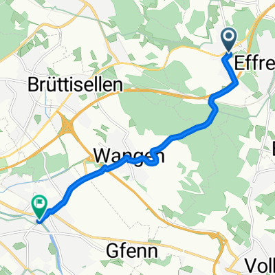
Long way home #1 58 km
A cycling route starting in Tagelswangen, Canton of Zurich, Switzerland.
Overview
About this route
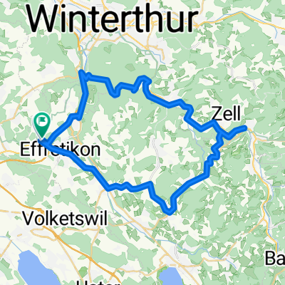
Rundtour Eschlikon
- -:--
- Duration
- 58.8 km
- Distance
- 416 m
- Ascent
- 493 m
- Descent
- ---
- Avg. speed
- ---
- Max. altitude

Route quality
Waytypes & surfaces along the route
Waytypes
Road
17.6 km
(30 %)
Quiet road
13.5 km
(23 %)
Surfaces
Paved
52.3 km
(89 %)
Unpaved
1.8 km
(3 %)
Asphalt
52.3 km
(89 %)
Gravel
1.2 km
(2 %)
Continue with Bikemap
Use, edit, or download this cycling route
You would like to ride Long way home #1 58 km or customize it for your own trip? Here is what you can do with this Bikemap route:
Free features
- Save this route as favorite or in collections
- Copy & plan your own version of this route
- Sync your route with Garmin or Wahoo
Premium features
Free trial for 3 days, or one-time payment. More about Bikemap Premium.
- Navigate this route on iOS & Android
- Export a GPX / KML file of this route
- Create your custom printout (try it for free)
- Download this route for offline navigation
Discover more Premium features.
Get Bikemap PremiumFrom our community
Other popular routes starting in Tagelswangen
 Brütten - Obermettmenstett - Oberembrach - Eigental - Lindau
- Distance
- 29.3 km
- Ascent
- 453 m
- Descent
- 452 m
- Location
- Tagelswangen, Canton of Zurich, Switzerland
 Huebstrasse 7, Tagelswangen to Bahnhofstrasse 45, Dübendorf
- Distance
- 6.6 km
- Ascent
- 30 m
- Descent
- 110 m
- Location
- Tagelswangen, Canton of Zurich, Switzerland
 Lindau-Häutligen
- Distance
- 152.1 km
- Ascent
- 725 m
- Descent
- 503 m
- Location
- Tagelswangen, Canton of Zurich, Switzerland
 Sonnenbühl, Wülflingen
- Distance
- 23.8 km
- Ascent
- 428 m
- Descent
- 430 m
- Location
- Tagelswangen, Canton of Zurich, Switzerland
 Tagelswangen -Kaisten
- Distance
- 70.4 km
- Ascent
- 222 m
- Descent
- 410 m
- Location
- Tagelswangen, Canton of Zurich, Switzerland
 31.5k Ottikon-Theilingen-Eschenberg
- Distance
- 31.5 km
- Ascent
- 320 m
- Descent
- 395 m
- Location
- Tagelswangen, Canton of Zurich, Switzerland
 Tagelswangen - Russikon-Tösstal
- Distance
- 43.3 km
- Ascent
- 381 m
- Descent
- 381 m
- Location
- Tagelswangen, Canton of Zurich, Switzerland
 Lindau - Gommiswald
- Distance
- 45.1 km
- Ascent
- 468 m
- Descent
- 347 m
- Location
- Tagelswangen, Canton of Zurich, Switzerland
Open it in the app