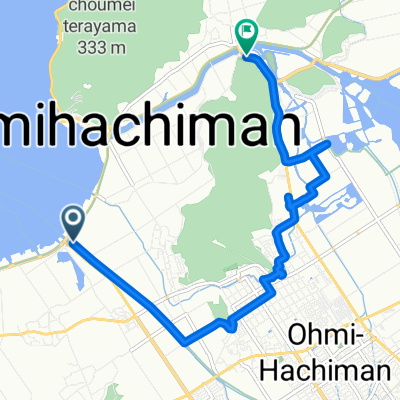
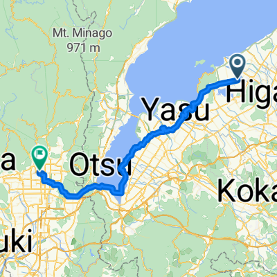
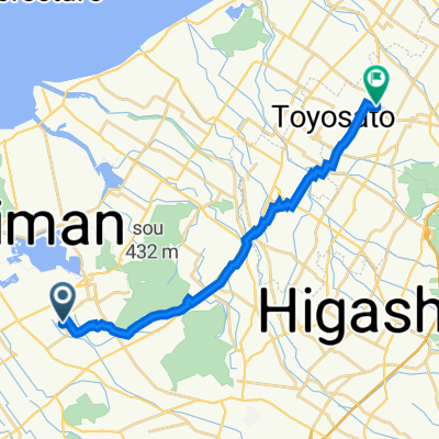
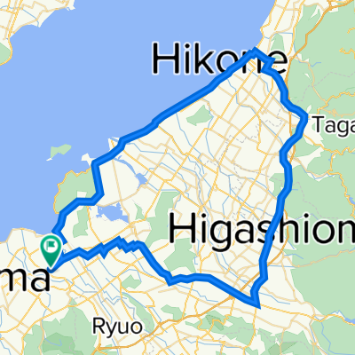
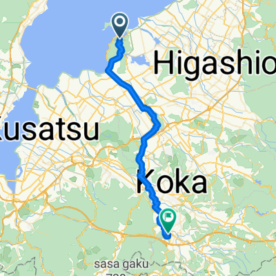
一般県道近江八幡安土能登川自転車道線(びわ湖よし笛ロード)
A cycling route starting in Ōmihachiman, Shiga Prefecture, Japan.
Overview
About this route
- -:--
- Duration
- 25.6 km
- Distance
- 85 m
- Ascent
- 90 m
- Descent
- ---
- Avg. speed
- ---
- Max. altitude
Route quality
Waytypes & surfaces along the route
Waytypes
Cycleway
14.8 km
(58 %)
Quiet road
2 km
(8 %)
Surfaces
Paved
18.7 km
(73 %)
Asphalt
16.6 km
(65 %)
Paved (undefined)
2 km
(8 %)
Undefined
6.9 km
(27 %)
Continue with Bikemap
Use, edit, or download this cycling route
You would like to ride 一般県道近江八幡安土能登川自転車道線(びわ湖よし笛ロード) or customize it for your own trip? Here is what you can do with this Bikemap route:
Free features
- Save this route as favorite or in collections
- Copy & plan your own version of this route
- Sync your route with Garmin or Wahoo
Premium features
Free trial for 3 days, or one-time payment. More about Bikemap Premium.
- Navigate this route on iOS & Android
- Export a GPX / KML file of this route
- Create your custom printout (try it for free)
- Download this route for offline navigation
Discover more Premium features.
Get Bikemap PremiumFrom our community
Other popular routes starting in Ōmihachiman
J2 Omihachiman-Moriyama-Kyoto-Kobe- Distance
- 124.4 km
- Ascent
- 166 m
- Descent
- 228 m
- Location
- Ōmihachiman, Shiga Prefecture, Japan
Nirasaki- Distance
- 431.8 km
- Ascent
- 658 m
- Descent
- 381 m
- Location
- Ōmihachiman, Shiga Prefecture, Japan
biwako half, Omihachiman to Takashima- Distance
- 85.7 km
- Ascent
- 286 m
- Descent
- 299 m
- Location
- Ōmihachiman, Shiga Prefecture, Japan
Spred Out Afternoon Track In Omihachiman- Distance
- 14.6 km
- Ascent
- 40 m
- Descent
- 42 m
- Location
- Ōmihachiman, Shiga Prefecture, Japan
県道199号, 近江八幡市 to 尼子1477, 犬上郡甲良町- Distance
- 18 km
- Ascent
- 71 m
- Descent
- 50 m
- Location
- Ōmihachiman, Shiga Prefecture, Japan
Japan2012 25.08- Distance
- 57.3 km
- Ascent
- 221 m
- Descent
- 273 m
- Location
- Ōmihachiman, Shiga Prefecture, Japan
Day3. 近江八幡至米原- Distance
- 35.2 km
- Ascent
- 70 m
- Descent
- 78 m
- Location
- Ōmihachiman, Shiga Prefecture, Japan
長田町, 近江八幡市 to 尼子1422, 犬上郡甲良町- Distance
- 17.5 km
- Ascent
- 35 m
- Descent
- 25 m
- Location
- Ōmihachiman, Shiga Prefecture, Japan
Open it in the app


