

からせん沿線コース
A cycling route starting in Ujiie, Tochigi, Japan.
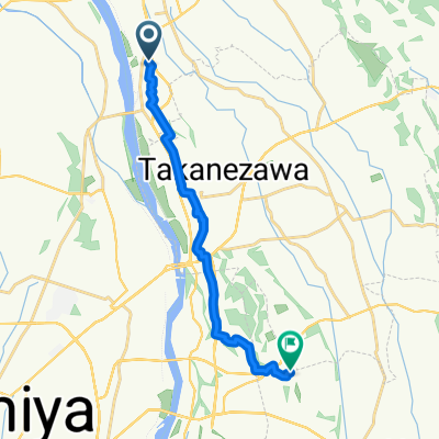
Overview
About this route
- -:--
- Duration
- 29.1 km
- Distance
- 242 m
- Ascent
- 300 m
- Descent
- ---
- Avg. speed
- ---
- Max. altitude

Route quality
Waytypes & surfaces along the route
Waytypes
Quiet road
13.7 km
(47 %)
Road
10.8 km
(37 %)
Surfaces
Paved
2 km
(7 %)
Asphalt
1.7 km
(6 %)
Paved (undefined)
0.3 km
(1 %)
Undefined
27.1 km
(93 %)
Continue with Bikemap
Use, edit, or download this cycling route
You would like to ride からせん沿線コース or customize it for your own trip? Here is what you can do with this Bikemap route:
Free features
- Save this route as favorite or in collections
- Copy & plan your own version of this route
- Sync your route with Garmin or Wahoo
Premium features
Free trial for 3 days, or one-time payment. More about Bikemap Premium.
- Navigate this route on iOS & Android
- Export a GPX / KML file of this route
- Create your custom printout (try it for free)
- Download this route for offline navigation
Discover more Premium features.
Get Bikemap PremiumFrom our community
Other popular routes starting in Ujiie
 高根沢⇔那須烏山 山岳コース
- Distance
- 103.7 km
- Ascent
- 1,960 m
- Descent
- 1,962 m
- Location
- Ujiie, Tochigi, Japan
 BRM707 PC6_PC7(GL)
- Distance
- 139.7 km
- Ascent
- 154 m
- Descent
- 225 m
- Location
- Ujiie, Tochigi, Japan
 高根沢町ファミリーコース
- Distance
- 7.8 km
- Ascent
- 34 m
- Descent
- 33 m
- Location
- Ujiie, Tochigi, Japan
 2384-31, Hoshakuji, Takanezawa, Shioya-Gun to Minami, Nasukarasuyama
- Distance
- 30.9 km
- Ascent
- 480 m
- Descent
- 542 m
- Location
- Ujiie, Tochigi, Japan
 からせん沿線コース
- Distance
- 29.1 km
- Ascent
- 242 m
- Descent
- 300 m
- Location
- Ujiie, Tochigi, Japan
 会社への道
会社への道- Distance
- 14.3 km
- Ascent
- 84 m
- Descent
- 113 m
- Location
- Ujiie, Tochigi, Japan
 宝石台4丁目, 高根沢町へ川向町, 宇都宮市
- Distance
- 11.8 km
- Ascent
- 90 m
- Descent
- 130 m
- Location
- Ujiie, Tochigi, Japan
Open it in the app