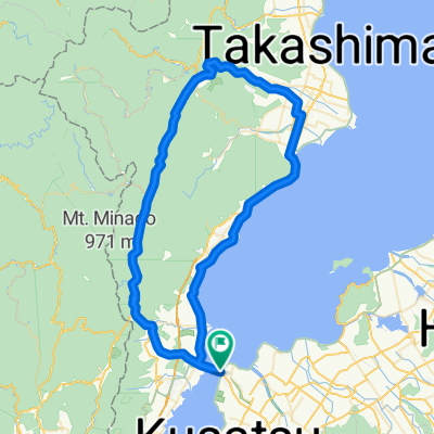
守山~近江八幡~彦根ルート
A cycling route starting in Kitahama, Shiga Prefecture, Japan.
Overview
About this route
- -:--
- Duration
- 96.3 km
- Distance
- 410 m
- Ascent
- 408 m
- Descent
- ---
- Avg. speed
- ---
- Avg. speed
Route quality
Waytypes & surfaces along the route
Waytypes
Busy road
50.8 km
(53 %)
Quiet road
25.1 km
(26 %)
Surfaces
Paved
64.8 km
(67 %)
Paved (undefined)
42.3 km
(44 %)
Asphalt
22.6 km
(23 %)
Undefined
31.5 km
(33 %)
Continue with Bikemap
Use, edit, or download this cycling route
You would like to ride 守山~近江八幡~彦根ルート or customize it for your own trip? Here is what you can do with this Bikemap route:
Free features
- Save this route as favorite or in collections
- Copy & plan your own version of this route
- Sync your route with Garmin or Wahoo
Premium features
Free trial for 3 days, or one-time payment. More about Bikemap Premium.
- Navigate this route on iOS & Android
- Export a GPX / KML file of this route
- Create your custom printout (try it for free)
- Download this route for offline navigation
Discover more Premium features.
Get Bikemap PremiumFrom our community
Other popular routes starting in Kitahama
- 志賀駅, 大津市 to 志賀駅, 大津市
- Distance
- 148.3 km
- Ascent
- 131 m
- Descent
- 168 m
- Location
- Kitahama, Shiga Prefecture, Japan
- Biwa Part 1
- Distance
- 150.9 km
- Ascent
- 242 m
- Descent
- 227 m
- Location
- Kitahama, Shiga Prefecture, Japan
- 道路, 守山市 to 2丁目 18, 大津市
- Distance
- 114.9 km
- Ascent
- 39 m
- Descent
- 59 m
- Location
- Kitahama, Shiga Prefecture, Japan
- 水保町1369-1, 守山市 to 江頭町627-9, 近江八幡市
- Distance
- 15.5 km
- Ascent
- 119 m
- Descent
- 120 m
- Location
- Kitahama, Shiga Prefecture, Japan
- 今浜町, 守山市 to 新浜町440-1, 草津市
- Distance
- 170.5 km
- Ascent
- 924 m
- Descent
- 921 m
- Location
- Kitahama, Shiga Prefecture, Japan
- lake biwa
- Distance
- 72.1 km
- Ascent
- 187 m
- Descent
- 155 m
- Location
- Kitahama, Shiga Prefecture, Japan
- Biwa Part 1
- Distance
- 75.7 km
- Ascent
- 204 m
- Descent
- 203 m
- Location
- Kitahama, Shiga Prefecture, Japan
- 2876-1, Imahamacho, Moriyama-Shi to Sazanami-kaido Street, Moriyama-Shi
- Distance
- 70 km
- Ascent
- 648 m
- Descent
- 648 m
- Location
- Kitahama, Shiga Prefecture, Japan
Open it in the app