

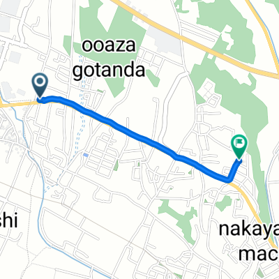
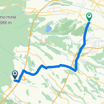
TOJコース
A cycling route starting in Komono, Mie, Japan.
Overview
About this route
- -:--
- Duration
- 20.1 km
- Distance
- 247 m
- Ascent
- 218 m
- Descent
- ---
- Avg. speed
- ---
- Max. altitude

Route quality
Waytypes & surfaces along the route
Waytypes
Road
5.6 km
(28 %)
Quiet road
3.2 km
(16 %)
Surfaces
Paved
15.9 km
(79 %)
Paved (undefined)
15.9 km
(79 %)
Undefined
4.2 km
(21 %)
Continue with Bikemap
Use, edit, or download this cycling route
You would like to ride TOJコース or customize it for your own trip? Here is what you can do with this Bikemap route:
Free features
- Save this route as favorite or in collections
- Copy & plan your own version of this route
- Sync your route with Garmin or Wahoo
Premium features
Free trial for 3 days, or one-time payment. More about Bikemap Premium.
- Navigate this route on iOS & Android
- Export a GPX / KML file of this route
- Create your custom printout (try it for free)
- Download this route for offline navigation
Discover more Premium features.
Get Bikemap PremiumFrom our community
Other popular routes starting in Komono
 酒荘 すずき
- Distance
- 1.3 km
- Ascent
- 22 m
- Descent
- 47 m
- Location
- Komono, Mie, Japan
 国道477号, 三重郡菰野町 to 内池920-3, 蒲生郡日野町
- Distance
- 37.7 km
- Ascent
- 1,105 m
- Descent
- 1,060 m
- Location
- Komono, Mie, Japan
 to Kyoto
- Distance
- 99.4 km
- Ascent
- 1,397 m
- Descent
- 1,477 m
- Location
- Komono, Mie, Japan
 1744-1, Yamamotocho, Suzuka to 443-1, Shukuno, Komono, Mie-Gun
- Distance
- 11 km
- Ascent
- 223 m
- Descent
- 350 m
- Location
- Komono, Mie, Japan
 Hokuseichoshimmachi, Inabe to 2-2, Kinjofuto 3-Chōme, Minato, Nagoya
- Distance
- 44.3 km
- Ascent
- 103 m
- Descent
- 276 m
- Location
- Komono, Mie, Japan
 267, Hokuseichoshimmachi, Inabe to 県道157号, Inabe
- Distance
- 25.1 km
- Ascent
- 830 m
- Descent
- 781 m
- Location
- Komono, Mie, Japan
 Inabe - Inuyama
- Distance
- 80.4 km
- Ascent
- 492 m
- Descent
- 497 m
- Location
- Komono, Mie, Japan
 1丁目 11, 東員町 to 東員町
- Distance
- 3.5 km
- Ascent
- 0 m
- Descent
- 52 m
- Location
- Komono, Mie, Japan
Open it in the app