

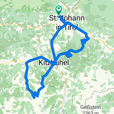
Schlechingrunde
A cycling route starting in Sankt Johann in Tirol, Tyrol, Austria.
Overview
About this route
- -:--
- Duration
- 73.3 km
- Distance
- 434 m
- Ascent
- 433 m
- Descent
- ---
- Avg. speed
- ---
- Max. altitude
Route quality
Waytypes & surfaces along the route
Waytypes
Quiet road
11 km
(15 %)
Cycleway
3.7 km
(5 %)
Surfaces
Paved
64.5 km
(88 %)
Asphalt
64.5 km
(88 %)
Undefined
8.8 km
(12 %)
Continue with Bikemap
Use, edit, or download this cycling route
You would like to ride Schlechingrunde or customize it for your own trip? Here is what you can do with this Bikemap route:
Free features
- Save this route as favorite or in collections
- Copy & plan your own version of this route
- Sync your route with Garmin or Wahoo
Premium features
Free trial for 3 days, or one-time payment. More about Bikemap Premium.
- Navigate this route on iOS & Android
- Export a GPX / KML file of this route
- Create your custom printout (try it for free)
- Download this route for offline navigation
Discover more Premium features.
Get Bikemap PremiumFrom our community
Other popular routes starting in Sankt Johann in Tirol
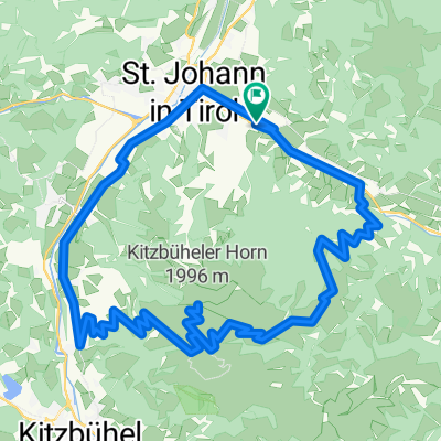 KitzhStJohan
- Distance
- 38.4 km
- Ascent
- 1,510 m
- Descent
- 1,512 m
- Location
- Sankt Johann in Tirol, Tyrol, Austria
 St. Johann im Tirol nach Telfs auf dem Innradweg
- Distance
- 133.9 km
- Ascent
- 944 m
- Descent
- 978 m
- Location
- Sankt Johann in Tirol, Tyrol, Austria
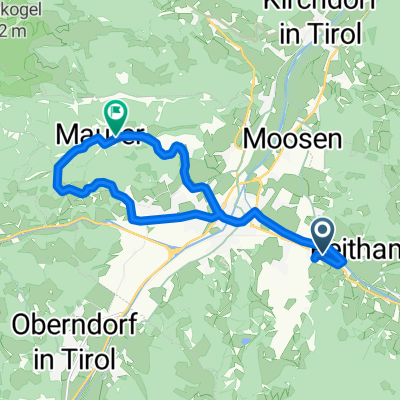
 Baumooskogelrunde
- Distance
- 22.2 km
- Ascent
- 862 m
- Descent
- 862 m
- Location
- Sankt Johann in Tirol, Tyrol, Austria
 Leukentalrunde mit Schwarzsee
- Distance
- 34.2 km
- Ascent
- 559 m
- Descent
- 561 m
- Location
- Sankt Johann in Tirol, Tyrol, Austria
 Hinterkaiser2
- Distance
- 23.9 km
- Ascent
- 345 m
- Descent
- 247 m
- Location
- Sankt Johann in Tirol, Tyrol, Austria
 Schlechingrunde
- Distance
- 73.3 km
- Ascent
- 434 m
- Descent
- 433 m
- Location
- Sankt Johann in Tirol, Tyrol, Austria
 Südbayern
- Distance
- 175.6 km
- Ascent
- 556 m
- Descent
- 714 m
- Location
- Sankt Johann in Tirol, Tyrol, Austria
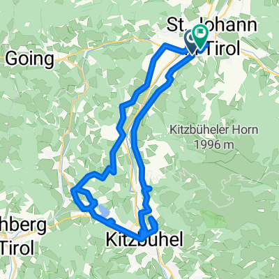
 St. Johan in Tirol-Kitzbühel
- Distance
- 71.6 km
- Ascent
- 2,882 m
- Descent
- 2,881 m
- Location
- Sankt Johann in Tirol, Tyrol, Austria
Open it in the app