

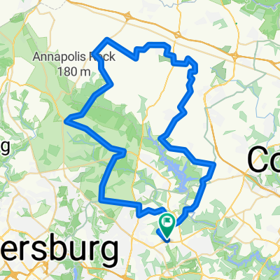
Sherwood/Howard County Loop
A cycling route starting in Ashton-Sandy Spring, Maryland, United States.
Overview
About this route
- -:--
- Duration
- 46 km
- Distance
- 389 m
- Ascent
- 388 m
- Descent
- ---
- Avg. speed
- ---
- Max. altitude

Route quality
Waytypes & surfaces along the route
Waytypes
Road
28 km
(61 %)
Quiet road
9.2 km
(20 %)
Surfaces
Paved
13.3 km
(29 %)
Asphalt
8.7 km
(19 %)
Paved (undefined)
4.6 km
(10 %)
Undefined
32.6 km
(71 %)
Continue with Bikemap
Use, edit, or download this cycling route
You would like to ride Sherwood/Howard County Loop or customize it for your own trip? Here is what you can do with this Bikemap route:
Free features
- Save this route as favorite or in collections
- Copy & plan your own version of this route
- Sync your route with Garmin or Wahoo
Premium features
Free trial for 3 days, or one-time payment. More about Bikemap Premium.
- Navigate this route on iOS & Android
- Export a GPX / KML file of this route
- Create your custom printout (try it for free)
- Download this route for offline navigation
Discover more Premium features.
Get Bikemap PremiumFrom our community
Other popular routes starting in Ashton-Sandy Spring
 210 Haviland Mill Rd, Ashton to 210 Haviland Mill Rd, Ashton
- Distance
- 5.1 km
- Ascent
- 110 m
- Descent
- 126 m
- Location
- Ashton-Sandy Spring, Maryland, United States
 Virginie no1 - trajet effectue
- Distance
- 576.4 km
- Ascent
- 1,912 m
- Descent
- 1,916 m
- Location
- Ashton-Sandy Spring, Maryland, United States
 Sherwood/Howard County Loop
- Distance
- 46 km
- Ascent
- 389 m
- Descent
- 388 m
- Location
- Ashton-Sandy Spring, Maryland, United States
 16968–16998 Harbour Town Dr, Silver Spring to 1104 Spotswood Dr, Silver Spring
- Distance
- 5.8 km
- Ascent
- 117 m
- Descent
- 95 m
- Location
- Ashton-Sandy Spring, Maryland, United States
 HoMontCo challenge 46
- Distance
- 73.5 km
- Ascent
- 838 m
- Descent
- 806 m
- Location
- Ashton-Sandy Spring, Maryland, United States
 1 (Maryland)
- Distance
- 52.2 km
- Ascent
- 485 m
- Descent
- 588 m
- Location
- Ashton-Sandy Spring, Maryland, United States
 1 (Maryland)
- Distance
- 60.4 km
- Ascent
- 816 m
- Descent
- 809 m
- Location
- Ashton-Sandy Spring, Maryland, United States
Open it in the app