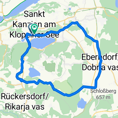
5.Tag Klopeiner See nach Klagenfurt
- 56.1 km
- 207 m
- 250 m
- Eberndorf, Carinthia, Austria
A cycling route starting in Eberndorf, Carinthia, Austria.
Overview
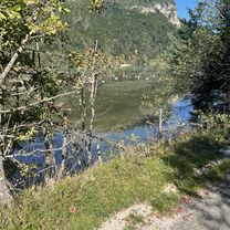
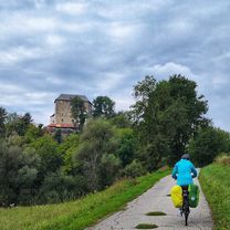
Tolle Tour entlang der Karawanken und der Drau. Am Radweg geht es von Klopein aus über Eberndorf und Sittersdorf nach Bad Eisenkappel. Am Ortsbeginn von Bad Eisenkappel rechts Richtung Schaida Sattel abbiegen. Der Anstieg zum Schaida Sattel ist ca. 5 km lang und hat eine Steigung von 12 %. Vor dem Anstieg zahlt sich ein Abstecher in die Trögerner Klamm auf alle Fälle aus. Am Schaidasattel angekommen hat man erstmals den wunderschönen Blick auf den Koschutnikturm der Karawanken. Die Abfahrt nach Zell Pfarre ist in einem schlechten Zustand. Wenn man langsam fährt, dann geht das schon. Dafür bleibt mehr Zeit um das Panorama zu geniessen. Bis nach Zell Pfarre und Ferlach sollte man nicht nur stur in die Pedale treten, sonder auch die gepflegte Kulturlandschaft geniessen. Von Ferlach geht es dann über die Landstrasse hinauf nach St. Margarethen. Zwei kurze Anstiege hat man noch zu überwinden, bevor man in St. Margarethen nach links hinunter zur Drau abbiegt. Man fährt nun über eine schmale Brücke und dann ein paar Kilometer auf flachem Gelände zur Annabrücke und dann nach Gallizien. Von dort sind es dann noch 10 km zurück zum Klopeinersee.<br />
created this 15 years ago
Route quality
Road
30.8 km
37 %
Quiet road
15 km
18 %
Paved
54.1 km
(65 %)
Asphalt
46.6 km
56 %
Paved (undefined)
7.5 km
9 %
Undefined
29.1 km
35 %
Continue with Bikemap
You would like to ride Ferlach Tour or customize it for your own trip? Here is what you can do with this Bikemap route:
Free trial for 3 days, or one-time payment. More about Bikemap Premium.
Discover more Premium features.
Get Bikemap PremiumFrom our community
Open it in the app