Elbinger Straße 10, Troisdorf nach Hummerich 2, Niederkassel
A cycling route starting in Troisdorf, North Rhine-Westphalia, Germany.
Overview
About this route
- 2 h 24 min
- Duration
- 23.3 km
- Distance
- 35 m
- Ascent
- 37 m
- Descent
- 9.7 km/h
- Avg. speed
- ---
- Max. altitude
Route quality
Waytypes & surfaces along the route
Waytypes
Path
16.3 km
(70 %)
Quiet road
3.5 km
(15 %)
Surfaces
Paved
20 km
(86 %)
Unpaved
1.6 km
(7 %)
Asphalt
20 km
(86 %)
Gravel
1.6 km
(7 %)
Undefined
1.6 km
(7 %)
Continue with Bikemap
Use, edit, or download this cycling route
You would like to ride Elbinger Straße 10, Troisdorf nach Hummerich 2, Niederkassel or customize it for your own trip? Here is what you can do with this Bikemap route:
Free features
- Save this route as favorite or in collections
- Copy & plan your own version of this route
- Sync your route with Garmin or Wahoo
Premium features
Free trial for 3 days, or one-time payment. More about Bikemap Premium.
- Navigate this route on iOS & Android
- Export a GPX / KML file of this route
- Create your custom printout (try it for free)
- Download this route for offline navigation
Discover more Premium features.
Get Bikemap PremiumFrom our community
Other popular routes starting in Troisdorf
- Troisdorf Bensberg Heiligenhaus Lohmar
- Distance
- 52.3 km
- Ascent
- 338 m
- Descent
- 331 m
- Location
- Troisdorf, North Rhine-Westphalia, Germany
- WahnN4
- Distance
- 34.7 km
- Ascent
- 235 m
- Descent
- 231 m
- Location
- Troisdorf, North Rhine-Westphalia, Germany
- Naafbachtalrunde
- Distance
- 32.8 km
- Ascent
- 429 m
- Descent
- 417 m
- Location
- Troisdorf, North Rhine-Westphalia, Germany
- Louis-Mannstaedt-Straße 42, Troisdorf nach Louis-Mannstaedt-Straße 42, Troisdorf
- Distance
- 26.8 km
- Ascent
- 147 m
- Descent
- 157 m
- Location
- Troisdorf, North Rhine-Westphalia, Germany
- Rund um Troisdorf
- Distance
- 26.2 km
- Ascent
- 92 m
- Descent
- 93 m
- Location
- Troisdorf, North Rhine-Westphalia, Germany
- Wahner Heide - Wahnbachtalsperre
- Distance
- 47.6 km
- Ascent
- 419 m
- Descent
- 419 m
- Location
- Troisdorf, North Rhine-Westphalia, Germany
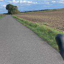
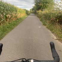
- Gertrud-Bäumer-Straße, Troisdorf nach Gertrud-Bäumer-Straße, Troisdorf
- Distance
- 13.4 km
- Ascent
- 14 m
- Descent
- 13 m
- Location
- Troisdorf, North Rhine-Westphalia, Germany
- Drachenfelser Ländchen - Remagen
- Distance
- 73.1 km
- Ascent
- 260 m
- Descent
- 258 m
- Location
- Troisdorf, North Rhine-Westphalia, Germany
Open it in the app