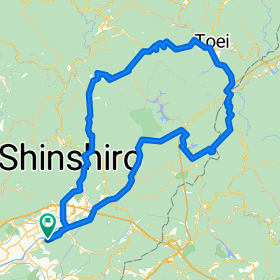
桐谷の渡しと大野宿 望月街道コース
A cycling route starting in Shinshiro, Aichi, Japan.
Overview
About this route
- -:--
- Duration
- 3.6 km
- Distance
- 90 m
- Ascent
- 92 m
- Descent
- ---
- Avg. speed
- ---
- Avg. speed
Continue with Bikemap
Use, edit, or download this cycling route
You would like to ride 桐谷の渡しと大野宿 望月街道コース or customize it for your own trip? Here is what you can do with this Bikemap route:
Free features
- Save this route as favorite or in collections
- Copy & plan your own version of this route
- Sync your route with Garmin or Wahoo
Premium features
Free trial for 3 days, or one-time payment. More about Bikemap Premium.
- Navigate this route on iOS & Android
- Export a GPX / KML file of this route
- Create your custom printout (try it for free)
- Download this route for offline navigation
Discover more Premium features.
Get Bikemap PremiumFrom our community
Other popular routes starting in Shinshiro
- Hongu Loop
- Distance
- 110 km
- Ascent
- 1,698 m
- Descent
- 1,698 m
- Location
- Shinshiro, Aichi, Japan
- 新城もっくる-鳳来寺
- Distance
- 38 km
- Ascent
- 578 m
- Descent
- 579 m
- Location
- Shinshiro, Aichi, Japan
- 香恋の里~つくで手作り村~三河湖
- Distance
- 38.1 km
- Ascent
- 414 m
- Descent
- 432 m
- Location
- Shinshiro, Aichi, Japan
- 新城もっくる-鳳来寺山
- Distance
- 28.8 km
- Ascent
- 636 m
- Descent
- 636 m
- Location
- Shinshiro, Aichi, Japan
- 桐谷の渡しと大野宿 望月街道コース
- Distance
- 3.6 km
- Ascent
- 90 m
- Descent
- 92 m
- Location
- Shinshiro, Aichi, Japan
- Sakurabuchi-Shinshiro
- Distance
- 43.2 km
- Ascent
- 358 m
- Descent
- 361 m
- Location
- Shinshiro, Aichi, Japan
- 15 Shinshiro -Kakegawa city
- Distance
- 70.5 km
- Ascent
- 958 m
- Descent
- 995 m
- Location
- Shinshiro, Aichi, Japan
- 新城もっくる-本宮山
- Distance
- 38.3 km
- Ascent
- 787 m
- Descent
- 790 m
- Location
- Shinshiro, Aichi, Japan
Open it in the app