

高野地スカイラインコース
A cycling route starting in Ikata-chō, Ehime, Japan.
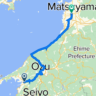
Overview
About this route
- -:--
- Duration
- 15.6 km
- Distance
- 433 m
- Ascent
- 432 m
- Descent
- ---
- Avg. speed
- ---
- Max. altitude

Continue with Bikemap
Use, edit, or download this cycling route
You would like to ride 高野地スカイラインコース or customize it for your own trip? Here is what you can do with this Bikemap route:
Free features
- Save this route as favorite or in collections
- Copy & plan your own version of this route
- Sync your route with Garmin or Wahoo
Premium features
Free trial for 3 days, or one-time payment. More about Bikemap Premium.
- Navigate this route on iOS & Android
- Export a GPX / KML file of this route
- Create your custom printout (try it for free)
- Download this route for offline navigation
Discover more Premium features.
Get Bikemap PremiumFrom our community
Other popular routes starting in Ikata-chō
 松山 to 三崎 part 3
- Distance
- 33.8 km
- Ascent
- 933 m
- Descent
- 953 m
- Location
- Ikata-chō, Ehime, Japan
 郷の峠・金山出石寺コース
- Distance
- 19.2 km
- Ascent
- 931 m
- Descent
- 157 m
- Location
- Ikata-chō, Ehime, Japan
 保内・八幡浜まちなみ散策コース
- Distance
- 12.9 km
- Ascent
- 207 m
- Descent
- 209 m
- Location
- Ikata-chō, Ehime, Japan
 平家谷・瞽女が峠旧道コース
- Distance
- 31.9 km
- Ascent
- 1,033 m
- Descent
- 1,033 m
- Location
- Ikata-chō, Ehime, Japan
 灯台疾走コース
- Distance
- 47.9 km
- Ascent
- 1,854 m
- Descent
- 1,849 m
- Location
- Ikata-chō, Ehime, Japan
 双岩・真穴周遊コース
- Distance
- 42.9 km
- Ascent
- 1,321 m
- Descent
- 1,324 m
- Location
- Ikata-chō, Ehime, Japan
 Day 556-2
- Distance
- 57.1 km
- Ascent
- 569 m
- Descent
- 562 m
- Location
- Ikata-chō, Ehime, Japan
 yawamahata-ouz-matsuyama
- Distance
- 80 km
- Ascent
- 1,143 m
- Descent
- 1,131 m
- Location
- Ikata-chō, Ehime, Japan
Open it in the app