豊浦ヒルクライムチャレンジコース
A cycling route starting in Date, Hokkaido, Japan.
Overview
About this route
- -:--
- Duration
- 41.7 km
- Distance
- 853 m
- Ascent
- 857 m
- Descent
- ---
- Avg. speed
- ---
- Max. altitude
Route quality
Waytypes & surfaces along the route
Waytypes
Busy road
24.9 km
(60 %)
Road
8 km
(19 %)
Surfaces
Paved
18.7 km
(45 %)
Asphalt
18.7 km
(45 %)
Undefined
23 km
(55 %)
Continue with Bikemap
Use, edit, or download this cycling route
You would like to ride 豊浦ヒルクライムチャレンジコース or customize it for your own trip? Here is what you can do with this Bikemap route:
Free features
- Save this route as favorite or in collections
- Copy & plan your own version of this route
- Sync your route with Garmin or Wahoo
Premium features
Free trial for 3 days, or one-time payment. More about Bikemap Premium.
- Navigate this route on iOS & Android
- Export a GPX / KML file of this route
- Create your custom printout (try it for free)
- Download this route for offline navigation
Discover more Premium features.
Get Bikemap PremiumFrom our community
Other popular routes starting in Date
- 豊浦ヒルクライムチャレンジコース
- Distance
- 41.7 km
- Ascent
- 853 m
- Descent
- 857 m
- Location
- Date, Hokkaido, Japan
- Around Lake Toya
- Distance
- 36.1 km
- Ascent
- 153 m
- Descent
- 154 m
- Location
- Date, Hokkaido, Japan
- IM JAPAN HOKKAIDO
- Distance
- 186.7 km
- Ascent
- 1,110 m
- Descent
- 1,109 m
- Location
- Date, Hokkaido, Japan
- Day 67: Lake Shikotsu
- Distance
- 155.2 km
- Ascent
- 1,855 m
- Descent
- 1,751 m
- Location
- Date, Hokkaido, Japan
- D23-仲洞爺湖_大沼
- Distance
- 151.7 km
- Ascent
- 879 m
- Descent
- 839 m
- Location
- Date, Hokkaido, Japan
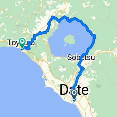
- 上長和萩原線, Date to Hokuto
- Distance
- 265.9 km
- Ascent
- 3,461 m
- Descent
- 3,605 m
- Location
- Date, Hokkaido, Japan
- Lake Toyako to Mori
- Distance
- 117.7 km
- Ascent
- 553 m
- Descent
- 644 m
- Location
- Date, Hokkaido, Japan
- R05_洞爺湖-室蘭岬
- Distance
- 51.2 km
- Ascent
- 173 m
- Descent
- 261 m
- Location
- Date, Hokkaido, Japan
Open it in the app