

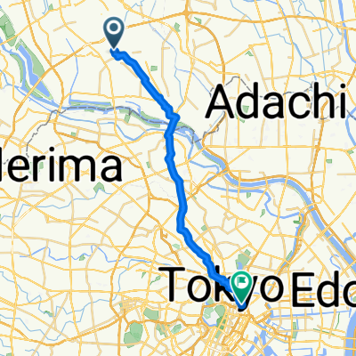
14 南部まちめぐりルート
A cycling route starting in Shimotoda, Saitama, Japan.
Overview
About this route
- -:--
- Duration
- 8.9 km
- Distance
- 12 m
- Ascent
- 18 m
- Descent
- ---
- Avg. speed
- ---
- Max. altitude

Continue with Bikemap
Use, edit, or download this cycling route
You would like to ride 14 南部まちめぐりルート or customize it for your own trip? Here is what you can do with this Bikemap route:
Free features
- Save this route as favorite or in collections
- Copy & plan your own version of this route
- Sync your route with Garmin or Wahoo
Premium features
Free trial for 3 days, or one-time payment. More about Bikemap Premium.
- Navigate this route on iOS & Android
- Export a GPX / KML file of this route
- Create your custom printout (try it for free)
- Download this route for offline navigation
Discover more Premium features.
Get Bikemap PremiumFrom our community
Other popular routes starting in Shimotoda
 喜沢1丁目6-7, 戸田市 to 西新宿6丁目7-2, 新宿区
- Distance
- 16.1 km
- Ascent
- 94 m
- Descent
- 61 m
- Location
- Shimotoda, Saitama, Japan
 Fast ride in Minami-Ku, Saitama-Shi
- Distance
- 31.4 km
- Ascent
- 0 m
- Descent
- 7 m
- Location
- Shimotoda, Saitama, Japan
 Retour 2
- Distance
- 17.3 km
- Ascent
- 74 m
- Descent
- 82 m
- Location
- Shimotoda, Saitama, Japan
 9-chōme 20, Itabashi City to 3-chōme 1, Itabashi City
- Distance
- 3.2 km
- Ascent
- 42 m
- Descent
- 47 m
- Location
- Shimotoda, Saitama, Japan
 大谷口 まで大谷口
- Distance
- 74.9 km
- Ascent
- 357 m
- Descent
- 358 m
- Location
- Shimotoda, Saitama, Japan
 tokyo - kyoto part1
- Distance
- 60.5 km
- Ascent
- 243 m
- Descent
- 233 m
- Location
- Shimotoda, Saitama, Japan
 ¿? Ò?到¿? Ò?
- Distance
- 21.6 km
- Ascent
- 193 m
- Descent
- 187 m
- Location
- Shimotoda, Saitama, Japan
 14 南部まちめぐりルート
- Distance
- 8.9 km
- Ascent
- 12 m
- Descent
- 18 m
- Location
- Shimotoda, Saitama, Japan
Open it in the app