

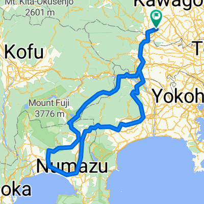
60 狭山ふれあいルート
A cycling route starting in Sayama, Saitama, Japan.
Overview
About this route
- -:--
- Duration
- 29.1 km
- Distance
- 262 m
- Ascent
- 261 m
- Descent
- ---
- Avg. speed
- ---
- Max. altitude

Route quality
Waytypes & surfaces along the route
Waytypes
Road
11.9 km
(41 %)
Quiet road
10.8 km
(37 %)
Surfaces
Paved
1.5 km
(5 %)
Paved (undefined)
1.2 km
(4 %)
Asphalt
0.3 km
(1 %)
Undefined
27.6 km
(95 %)
Continue with Bikemap
Use, edit, or download this cycling route
You would like to ride 60 狭山ふれあいルート or customize it for your own trip? Here is what you can do with this Bikemap route:
Free features
- Save this route as favorite or in collections
- Copy & plan your own version of this route
- Sync your route with Garmin or Wahoo
Premium features
Free trial for 3 days, or one-time payment. More about Bikemap Premium.
- Navigate this route on iOS & Android
- Export a GPX / KML file of this route
- Create your custom printout (try it for free)
- Download this route for offline navigation
Discover more Premium features.
Get Bikemap PremiumFrom our community
Other popular routes starting in Sayama
 東北1700kmの実績
- Distance
- 1,764.4 km
- Ascent
- 2,609 m
- Descent
- 2,604 m
- Location
- Sayama, Saitama, Japan
 2013お盆ツー1日目
- Distance
- 790.2 km
- Ascent
- 5,069 m
- Descent
- 5,149 m
- Location
- Sayama, Saitama, Japan
 2丁目 15, 狭山市 まで2丁目 15, 狭山市
- Distance
- 82.1 km
- Ascent
- 1,850 m
- Descent
- 1,851 m
- Location
- Sayama, Saitama, Japan
 BRM429 START-PC1
- Distance
- 98.9 km
- Ascent
- 150 m
- Descent
- 141 m
- Location
- Sayama, Saitama, Japan
 324愛鷹 ALL
- Distance
- 301.7 km
- Ascent
- 2,642 m
- Descent
- 2,642 m
- Location
- Sayama, Saitama, Japan
 多摩サイ阿蘇神社まで
- Distance
- 68.6 km
- Ascent
- 202 m
- Descent
- 202 m
- Location
- Sayama, Saitama, Japan
 Lake Okutama 3
- Distance
- 52.9 km
- Ascent
- 833 m
- Descent
- 212 m
- Location
- Sayama, Saitama, Japan
 60 狭山ふれあいルート
- Distance
- 29.1 km
- Ascent
- 262 m
- Descent
- 261 m
- Location
- Sayama, Saitama, Japan
Open it in the app