

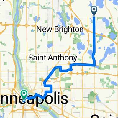
rice creek regional trail- 15.7
A cycling route starting in Shoreview, Minnesota, United States of America.
Overview
About this route
- -:--
- Duration
- 25.4 km
- Distance
- 59 m
- Ascent
- 59 m
- Descent
- ---
- Avg. speed
- ---
- Max. altitude

Route quality
Waytypes & surfaces along the route
Waytypes
Cycleway
11.4 km
(45 %)
Quiet road
4.8 km
(19 %)
Surfaces
Paved
20.4 km
(80 %)
Asphalt
18.9 km
(74 %)
Paved (undefined)
1.4 km
(5 %)
Continue with Bikemap
Use, edit, or download this cycling route
You would like to ride rice creek regional trail- 15.7 or customize it for your own trip? Here is what you can do with this Bikemap route:
Free features
- Save this route as favorite or in collections
- Copy & plan your own version of this route
- Sync your route with Garmin or Wahoo
Premium features
Free trial for 3 days, or one-time payment. More about Bikemap Premium.
- Navigate this route on iOS & Android
- Export a GPX / KML file of this route
- Create your custom printout (try it for free)
- Download this route for offline navigation
Discover more Premium features.
Get Bikemap PremiumFrom our community
Other popular routes starting in Shoreview
 rice creek regional trail- 15.7
- Distance
- 25.4 km
- Ascent
- 59 m
- Descent
- 59 m
- Location
- Shoreview, Minnesota, United States of America
 rice creek trails- 17 mi
- Distance
- 27.4 km
- Ascent
- 53 m
- Descent
- 50 m
- Location
- Shoreview, Minnesota, United States of America
 north oaks
- Distance
- 24.5 km
- Ascent
- 115 m
- Descent
- 114 m
- Location
- Shoreview, Minnesota, United States of America
 Northoaks route-13 mi
- Distance
- 21 km
- Ascent
- 107 m
- Descent
- 102 m
- Location
- Shoreview, Minnesota, United States of America
 Watermelon 1997
- Distance
- 37.1 km
- Ascent
- 162 m
- Descent
- 162 m
- Location
- Shoreview, Minnesota, United States of America
 turtle tri
- Distance
- 19.9 km
- Ascent
- 75 m
- Descent
- 75 m
- Location
- Shoreview, Minnesota, United States of America
 sucker creek to snail lake 15 mi route
- Distance
- 23.8 km
- Ascent
- 87 m
- Descent
- 84 m
- Location
- Shoreview, Minnesota, United States of America
 B2B00466 55126>55402 via Lexington, Co Rd C, Mpls Diagonal Trl, 15th Av SE
- Distance
- 23.1 km
- Ascent
- 137 m
- Descent
- 137 m
- Location
- Shoreview, Minnesota, United States of America
Open it in the app