

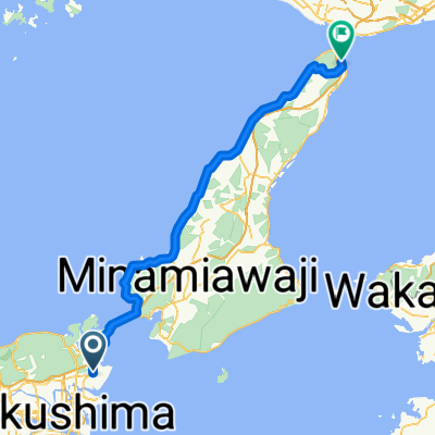
鳴門市シティコース(長距離)
A cycling route starting in Narutochō-mitsuishi, Tokushima, Japan.
Overview
About this route
- -:--
- Duration
- 58 km
- Distance
- 978 m
- Ascent
- 978 m
- Descent
- ---
- Avg. speed
- ---
- Max. altitude

Route quality
Waytypes & surfaces along the route
Waytypes
Quiet road
10.4 km
(18 %)
Cycleway
7 km
(12 %)
Surfaces
Paved
8.1 km
(14 %)
Asphalt
7 km
(12 %)
Paved (undefined)
1.2 km
(2 %)
Undefined
49.9 km
(86 %)
Continue with Bikemap
Use, edit, or download this cycling route
You would like to ride 鳴門市シティコース(長距離) or customize it for your own trip? Here is what you can do with this Bikemap route:
Free features
- Save this route as favorite or in collections
- Copy & plan your own version of this route
- Sync your route with Garmin or Wahoo
Premium features
Free trial for 3 days, or one-time payment. More about Bikemap Premium.
- Navigate this route on iOS & Android
- Export a GPX / KML file of this route
- Create your custom printout (try it for free)
- Download this route for offline navigation
Discover more Premium features.
Get Bikemap PremiumFrom our community
Other popular routes starting in Narutochō-mitsuishi
 鳴門徳島自転車道
- Distance
- 31.6 km
- Ascent
- 20 m
- Descent
- 22 m
- Location
- Narutochō-mitsuishi, Tokushima, Japan
 Kuroyama, Naruto to Kita, Naruto
- Distance
- 51.2 km
- Ascent
- 550 m
- Descent
- 552 m
- Location
- Narutochō-mitsuishi, Tokushima, Japan
 トライアングルコース(山)鳴門市
- Distance
- 17.7 km
- Ascent
- 42 m
- Descent
- 40 m
- Location
- Narutochō-mitsuishi, Tokushima, Japan
 撫養町大桑島北ノ浜8-2, 鳴門市 to 中喜来稲本, 板野郡松茂町
- Distance
- 12.7 km
- Ascent
- 28 m
- Descent
- 25 m
- Location
- Narutochō-mitsuishi, Tokushima, Japan
 Japan Day 2
- Distance
- 77.2 km
- Ascent
- 386 m
- Descent
- 384 m
- Location
- Narutochō-mitsuishi, Tokushima, Japan
 Naruto - Iwaya
- Distance
- 80.4 km
- Ascent
- 425 m
- Descent
- 426 m
- Location
- Narutochō-mitsuishi, Tokushima, Japan
 Satourachosatoura Ebisu, Naruto to Satourachosatoura, Naruto
- Distance
- 15 km
- Ascent
- 6 m
- Descent
- 12 m
- Location
- Narutochō-mitsuishi, Tokushima, Japan
 鳴門市シティコース(短距離)
- Distance
- 30.6 km
- Ascent
- 312 m
- Descent
- 310 m
- Location
- Narutochō-mitsuishi, Tokushima, Japan
Open it in the app