

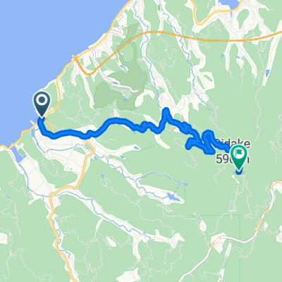
DRAGON Route
A cycling route starting in Hondomachi-hondo, Kumamoto, Japan.
Overview
About this route
- -:--
- Duration
- 19.1 km
- Distance
- 486 m
- Ascent
- 483 m
- Descent
- ---
- Avg. speed
- ---
- Max. altitude

Continue with Bikemap
Use, edit, or download this cycling route
You would like to ride DRAGON Route or customize it for your own trip? Here is what you can do with this Bikemap route:
Free features
- Save this route as favorite or in collections
- Copy & plan your own version of this route
- Sync your route with Garmin or Wahoo
Premium features
Free trial for 3 days, or one-time payment. More about Bikemap Premium.
- Navigate this route on iOS & Android
- Export a GPX / KML file of this route
- Create your custom printout (try it for free)
- Download this route for offline navigation
Discover more Premium features.
Get Bikemap PremiumFrom our community
Other popular routes starting in Hondomachi-hondo
 老岳クライム
- Distance
- 8.6 km
- Ascent
- 555 m
- Descent
- 53 m
- Location
- Hondomachi-hondo, Kumamoto, Japan
 DRAGON Route
- Distance
- 19.1 km
- Ascent
- 486 m
- Descent
- 483 m
- Location
- Hondomachi-hondo, Kumamoto, Japan
 龍ヶ岳クライム
- Distance
- 6.9 km
- Ascent
- 588 m
- Descent
- 130 m
- Location
- Hondomachi-hondo, Kumamoto, Japan
 本渡歴史探訪コース
- Distance
- 4.6 km
- Ascent
- 43 m
- Descent
- 42 m
- Location
- Hondomachi-hondo, Kumamoto, Japan
 Orange-line Route
- Distance
- 23.1 km
- Ascent
- 795 m
- Descent
- 795 m
- Location
- Hondomachi-hondo, Kumamoto, Japan
 Day 15: Unzen
- Distance
- 142.3 km
- Ascent
- 3,061 m
- Descent
- 2,840 m
- Location
- Hondomachi-hondo, Kumamoto, Japan
 2007/05/03本渡-三角駅
- Distance
- 50.1 km
- Ascent
- 352 m
- Descent
- 352 m
- Location
- Hondomachi-hondo, Kumamoto, Japan
 BIG-Challenge Route
- Distance
- 12.9 km
- Ascent
- 449 m
- Descent
- 497 m
- Location
- Hondomachi-hondo, Kumamoto, Japan
Open it in the app