

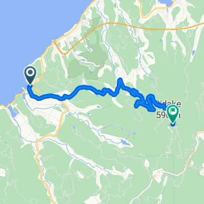
Orange-line Route
A cycling route starting in Hondomachi-hondo, Kumamoto, Japan.
Overview
About this route
- -:--
- Duration
- 23.1 km
- Distance
- 795 m
- Ascent
- 795 m
- Descent
- ---
- Avg. speed
- ---
- Max. altitude

Route quality
Waytypes & surfaces along the route
Waytypes
Road
19.4 km
(84 %)
Quiet road
1.2 km
(5 %)
Surfaces
Paved
0.7 km
(3 %)
Paved (undefined)
0.7 km
(3 %)
Undefined
22.4 km
(97 %)
Continue with Bikemap
Use, edit, or download this cycling route
You would like to ride Orange-line Route or customize it for your own trip? Here is what you can do with this Bikemap route:
Free features
- Save this route as favorite or in collections
- Copy & plan your own version of this route
- Sync your route with Garmin or Wahoo
Premium features
Free trial for 3 days, or one-time payment. More about Bikemap Premium.
- Navigate this route on iOS & Android
- Export a GPX / KML file of this route
- Create your custom printout (try it for free)
- Download this route for offline navigation
Discover more Premium features.
Get Bikemap PremiumFrom our community
Other popular routes starting in Hondomachi-hondo
 DRAGON Route
- Distance
- 19.1 km
- Ascent
- 486 m
- Descent
- 483 m
- Location
- Hondomachi-hondo, Kumamoto, Japan
 本渡歴史探訪コース
- Distance
- 4.6 km
- Ascent
- 43 m
- Descent
- 42 m
- Location
- Hondomachi-hondo, Kumamoto, Japan
 BIG-Challenge Route
- Distance
- 12.9 km
- Ascent
- 449 m
- Descent
- 497 m
- Location
- Hondomachi-hondo, Kumamoto, Japan
 Day 15: Unzen
- Distance
- 142.3 km
- Ascent
- 3,061 m
- Descent
- 2,840 m
- Location
- Hondomachi-hondo, Kumamoto, Japan
 Orange-line Route
- Distance
- 23.1 km
- Ascent
- 795 m
- Descent
- 795 m
- Location
- Hondomachi-hondo, Kumamoto, Japan
 2007/05/03本渡-三角駅
- Distance
- 50.1 km
- Ascent
- 352 m
- Descent
- 352 m
- Location
- Hondomachi-hondo, Kumamoto, Japan
 老岳クライム
- Distance
- 8.6 km
- Ascent
- 555 m
- Descent
- 53 m
- Location
- Hondomachi-hondo, Kumamoto, Japan
 龍ヶ岳クライム
- Distance
- 6.9 km
- Ascent
- 588 m
- Descent
- 130 m
- Location
- Hondomachi-hondo, Kumamoto, Japan
Open it in the app