20090711 秩父札所巡礼一番~二十二番
- 35.4 km
- 418 m
- 371 m
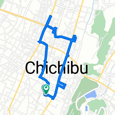
- Chichibu, Saitama, Japan
A cycling route starting in Chichibu, Saitama, Japan.
Overview
created this 6 years ago
Route quality
Quiet road
5.6 km
22 %
Road
1.3 km
5 %
Paved
1 km
(4 %)
Paved (undefined)
0.5 km
2 %
Asphalt
0.5 km
2 %
Undefined
24.5 km
96 %
Continue with Bikemap
You would like to ride 95 長瀞羊山芝桜ルート or customize it for your own trip? Here is what you can do with this Bikemap route:
Free trial for 3 days, or one-time payment. More about Bikemap Premium.
Discover more Premium features.
Get Bikemap PremiumFrom our community
Open it in the app