

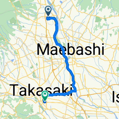
江戸川~利根川サイクリングロード(右岸)【東京 → 群馬】
A cycling route starting in Shibukawa, Gunma, Japan.
Overview
About this route
- -:--
- Duration
- 162.5 km
- Distance
- 483 m
- Ascent
- 669 m
- Descent
- ---
- Avg. speed
- ---
- Max. altitude

Route quality
Waytypes & surfaces along the route
Waytypes
Cycleway
125.1 km
(77 %)
Pedestrian area
17.9 km
(11 %)
Surfaces
Paved
66.6 km
(41 %)
Unpaved
1.6 km
(1 %)
Asphalt
39 km
(24 %)
Paved (undefined)
27.6 km
(17 %)
Continue with Bikemap
Use, edit, or download this cycling route
You would like to ride 江戸川~利根川サイクリングロード(右岸)【東京 → 群馬】 or customize it for your own trip? Here is what you can do with this Bikemap route:
Free features
- Save this route as favorite or in collections
- Copy & plan your own version of this route
- Split it into stages to create a multi-day tour
- Sync your route with Garmin or Wahoo
Premium features
Free trial for 3 days, or one-time payment. More about Bikemap Premium.
- Navigate this route on iOS & Android
- Export a GPX / KML file of this route
- Create your custom printout (try it for free)
- Download this route for offline navigation
Discover more Premium features.
Get Bikemap PremiumFrom our community
Other popular routes starting in Shibukawa
 IH2 Day 3
- Distance
- 69.5 km
- Ascent
- 2,163 m
- Descent
- 1,067 m
- Location
- Shibukawa, Gunma, Japan
 利根川CR 渋川〜栗橋
- Distance
- 100.3 km
- Ascent
- 9 m
- Descent
- 173 m
- Location
- Shibukawa, Gunma, Japan
 1134-4 to Takasaki Station
- Distance
- 25.9 km
- Ascent
- 80 m
- Descent
- 133 m
- Location
- Shibukawa, Gunma, Japan
 Day 3 從Kanouya到Kokumin Shukusha Sun Lake Kusaki的路線
- Distance
- 63 km
- Ascent
- 611 m
- Descent
- 931 m
- Location
- Shibukawa, Gunma, Japan
 61-6, Shibukawa to Kamisawatari, Nakanojo
- Distance
- 44.2 km
- Ascent
- 1,667 m
- Descent
- 1,701 m
- Location
- Shibukawa, Gunma, Japan
 36.497° N 139.014° W to 36.624° N 139.036° W
- Distance
- 21.8 km
- Ascent
- 965 m
- Descent
- 828 m
- Location
- Shibukawa, Gunma, Japan
 Shibukawa to Takasaki
- Distance
- 11.3 km
- Ascent
- 671 m
- Descent
- 311 m
- Location
- Shibukawa, Gunma, Japan
 2017/3/30
- Distance
- 94.9 km
- Ascent
- 1,379 m
- Descent
- 1,040 m
- Location
- Shibukawa, Gunma, Japan
Open it in the app