

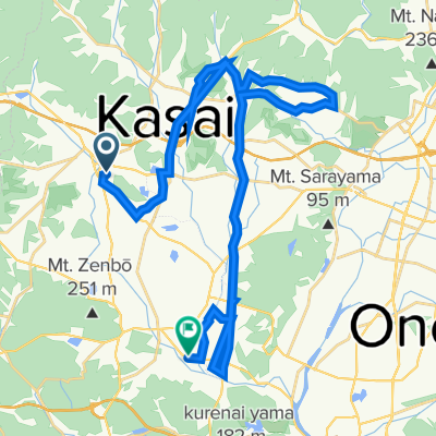
北部ど田舎周遊コース
A cycling route starting in Yashiro, Hyōgo, Japan.
Overview
About this route
- -:--
- Duration
- 24.1 km
- Distance
- 287 m
- Ascent
- 288 m
- Descent
- ---
- Avg. speed
- ---
- Max. altitude

Continue with Bikemap
Use, edit, or download this cycling route
You would like to ride 北部ど田舎周遊コース or customize it for your own trip? Here is what you can do with this Bikemap route:
Free features
- Save this route as favorite or in collections
- Copy & plan your own version of this route
- Sync your route with Garmin or Wahoo
Premium features
Free trial for 3 days, or one-time payment. More about Bikemap Premium.
- Navigate this route on iOS & Android
- Export a GPX / KML file of this route
- Create your custom printout (try it for free)
- Download this route for offline navigation
Discover more Premium features.
Get Bikemap PremiumFrom our community
Other popular routes starting in Yashiro
 加東市~鶉野飛行場~大橋ラーメン
- Distance
- 70 km
- Ascent
- 721 m
- Descent
- 720 m
- Location
- Yashiro, Hyōgo, Japan
 北条, 加西市 to 北条 1, 加西市
- Distance
- 67.5 km
- Ascent
- 1,903 m
- Descent
- 1,903 m
- Location
- Yashiro, Hyōgo, Japan
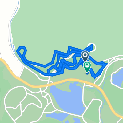
 北条の宿ポタリングコース
- Distance
- 3.7 km
- Ascent
- 16 m
- Descent
- 16 m
- Location
- Yashiro, Hyōgo, Japan
 加東市 ~加西市鶉野飛行場~西脇市
- Distance
- 96.1 km
- Ascent
- 1,093 m
- Descent
- 1,093 m
- Location
- Yashiro, Hyōgo, Japan
 加西三坂コース
- Distance
- 37.4 km
- Ascent
- 765 m
- Descent
- 766 m
- Location
- Yashiro, Hyōgo, Japan
 加東市~多可~加西市〜小野市
- Distance
- 217.1 km
- Ascent
- 1,785 m
- Descent
- 1,578 m
- Location
- Yashiro, Hyōgo, Japan
 591-15, Hojocho Nishitakamuro, Kasai to 2405, Taharacho, Kasai
- Distance
- 47 km
- Ascent
- 1,558 m
- Descent
- 1,601 m
- Location
- Yashiro, Hyōgo, Japan
 1274, 下滝野, Като до 1274, 下滝野, Като
- Distance
- 4.5 km
- Ascent
- 37 m
- Descent
- 35 m
- Location
- Yashiro, Hyōgo, Japan
Open it in the app