

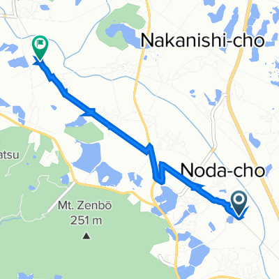
南部ぷちヒルクライムコース
A cycling route starting in Ono, Hyōgo, Japan.
Overview
About this route
- -:--
- Duration
- 17.5 km
- Distance
- 230 m
- Ascent
- 229 m
- Descent
- ---
- Avg. speed
- ---
- Max. altitude

Route quality
Waytypes & surfaces along the route
Waytypes
Quiet road
3 km
(17 %)
Track
2.1 km
(12 %)
Surfaces
Paved
12.4 km
(71 %)
Asphalt
12.4 km
(71 %)
Undefined
5.1 km
(29 %)
Continue with Bikemap
Use, edit, or download this cycling route
You would like to ride 南部ぷちヒルクライムコース or customize it for your own trip? Here is what you can do with this Bikemap route:
Free features
- Save this route as favorite or in collections
- Copy & plan your own version of this route
- Sync your route with Garmin or Wahoo
Premium features
Free trial for 3 days, or one-time payment. More about Bikemap Premium.
- Navigate this route on iOS & Android
- Export a GPX / KML file of this route
- Create your custom printout (try it for free)
- Download this route for offline navigation
Discover more Premium features.
Get Bikemap PremiumFrom our community
Other popular routes starting in Ono
 播磨中央自転車道
- Distance
- 32.1 km
- Ascent
- 184 m
- Descent
- 183 m
- Location
- Ono, Hyōgo, Japan
 県道79号, Kasai-Shi to Kamimiyakicho, Kasai-Shi
- Distance
- 5.8 km
- Ascent
- 20 m
- Descent
- 14 m
- Location
- Ono, Hyōgo, Japan
 南部ぷちヒルクライムコース
- Distance
- 17.5 km
- Ascent
- 230 m
- Descent
- 229 m
- Location
- Ono, Hyōgo, Japan
 304−2, 加西市 to 長駅, 加西市
- Distance
- 3.8 km
- Ascent
- 11 m
- Descent
- 3 m
- Location
- Ono, Hyōgo, Japan
 2274−11, 加西市 to 北条, 加西市
- Distance
- 71.6 km
- Ascent
- 643 m
- Descent
- 639 m
- Location
- Ono, Hyōgo, Japan
 播磨中央自転車道, 加西市 to 網引駅, 加西市
- Distance
- 0.6 km
- Ascent
- 0 m
- Descent
- 0 m
- Location
- Ono, Hyōgo, Japan
 播磨中央自転車道コース
- Distance
- 35.2 km
- Ascent
- 312 m
- Descent
- 311 m
- Location
- Ono, Hyōgo, Japan
 東・北はりまショート時計回り
- Distance
- 94.7 km
- Ascent
- 587 m
- Descent
- 587 m
- Location
- Ono, Hyōgo, Japan
Open it in the app