

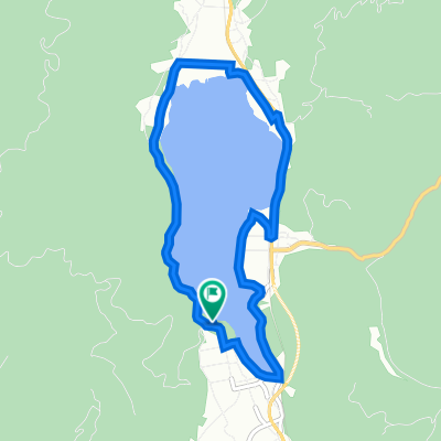
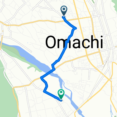
仁科三湖巡り
A cycling route starting in Ōmachi, Nagano, Japan.
Overview
About this route
- -:--
- Duration
- 37.8 km
- Distance
- 499 m
- Ascent
- 500 m
- Descent
- ---
- Avg. speed
- ---
- Max. altitude

Route quality
Waytypes & surfaces along the route
Waytypes
Road
15.5 km
(41 %)
Quiet road
12.5 km
(33 %)
Surfaces
Paved
5.3 km
(14 %)
Paved (undefined)
5.3 km
(14 %)
Undefined
32.5 km
(86 %)
Continue with Bikemap
Use, edit, or download this cycling route
You would like to ride 仁科三湖巡り or customize it for your own trip? Here is what you can do with this Bikemap route:
Free features
- Save this route as favorite or in collections
- Copy & plan your own version of this route
- Sync your route with Garmin or Wahoo
Premium features
Free trial for 3 days, or one-time payment. More about Bikemap Premium.
- Navigate this route on iOS & Android
- Export a GPX / KML file of this route
- Create your custom printout (try it for free)
- Download this route for offline navigation
Discover more Premium features.
Get Bikemap PremiumFrom our community
Other popular routes starting in Ōmachi
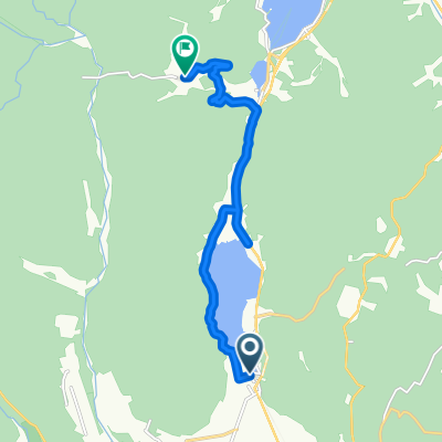
 青木湖・中綱湖ポタリング
- Distance
- 8.9 km
- Ascent
- 169 m
- Descent
- 169 m
- Location
- Ōmachi, Nagano, Japan
 0827大町-上越110km
- Distance
- 109.9 km
- Ascent
- 816 m
- Descent
- 1,527 m
- Location
- Ōmachi, Nagano, Japan
 木崎湖1周, 大町市
- Distance
- 8 km
- Ascent
- 30 m
- Descent
- 35 m
- Location
- Ōmachi, Nagano, Japan
 中綱林道コース
- Distance
- 11.3 km
- Ascent
- 470 m
- Descent
- 98 m
- Location
- Ōmachi, Nagano, Japan
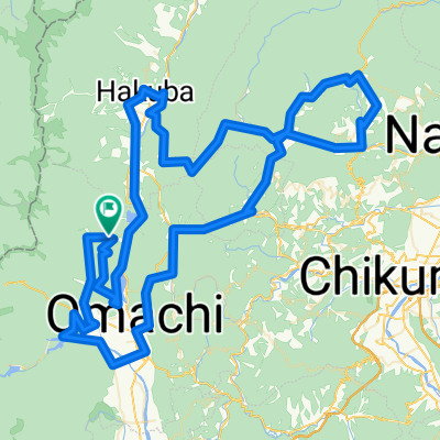
 恋する神社巡り
- Distance
- 56 km
- Ascent
- 728 m
- Descent
- 723 m
- Location
- Ōmachi, Nagano, Japan
 2020 北アルプス山麓グランフォンド 160㎞
- Distance
- 143.5 km
- Ascent
- 4,497 m
- Descent
- 4,500 m
- Location
- Ōmachi, Nagano, Japan
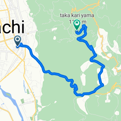 裏鷹狩コース
- Distance
- 9.4 km
- Ascent
- 540 m
- Descent
- 105 m
- Location
- Ōmachi, Nagano, Japan
 De 4608-2, Omachi Nakaharacho, Omachi a 6909-39, Tokiwa Izumi, Omachi
- Distance
- 3.7 km
- Ascent
- 17 m
- Descent
- 45 m
- Location
- Ōmachi, Nagano, Japan
Open it in the app