

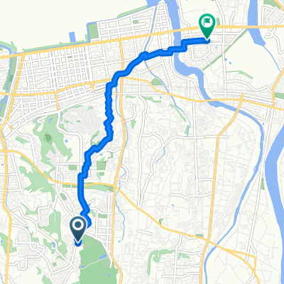
軽便鉄道跡探訪ルート(佐賀関エリア)
A cycling route starting in Tsurusaki, Oita, Japan.
Overview
About this route
- -:--
- Duration
- 8.2 km
- Distance
- 115 m
- Ascent
- 109 m
- Descent
- ---
- Avg. speed
- ---
- Max. altitude

Continue with Bikemap
Use, edit, or download this cycling route
You would like to ride 軽便鉄道跡探訪ルート(佐賀関エリア) or customize it for your own trip? Here is what you can do with this Bikemap route:
Free features
- Save this route as favorite or in collections
- Copy & plan your own version of this route
- Sync your route with Garmin or Wahoo
Premium features
Free trial for 3 days, or one-time payment. More about Bikemap Premium.
- Navigate this route on iOS & Android
- Export a GPX / KML file of this route
- Create your custom printout (try it for free)
- Download this route for offline navigation
Discover more Premium features.
Get Bikemap PremiumFrom our community
Other popular routes starting in Tsurusaki
 分高から三佐
- Distance
- 7.2 km
- Ascent
- 18 m
- Descent
- 109 m
- Location
- Tsurusaki, Oita, Japan
 本神崎35, 大分市 to 本神崎812, 大分市
- Distance
- 1.9 km
- Ascent
- 8 m
- Descent
- 0 m
- Location
- Tsurusaki, Oita, Japan
 軽便鉄道跡探訪ルート(佐賀関エリア)
- Distance
- 8.2 km
- Ascent
- 115 m
- Descent
- 109 m
- Location
- Tsurusaki, Oita, Japan
 TRANS KYUSHU RELAY 2017 B3
- Distance
- 20.6 km
- Ascent
- 115 m
- Descent
- 82 m
- Location
- Tsurusaki, Oita, Japan
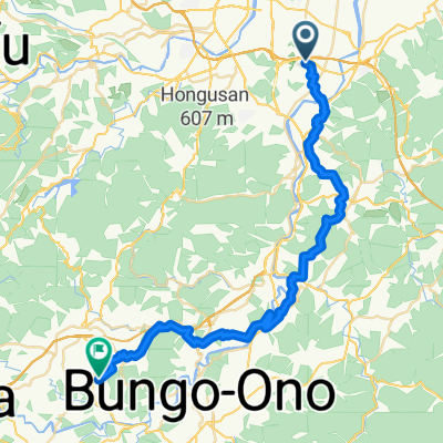 Tsurusaki - Takedamachi
- Distance
- 44.8 km
- Ascent
- 1,055 m
- Descent
- 911 m
- Location
- Tsurusaki, Oita, Japan
 馬場623, 大分市 to 馬場621-5, 大分市
- Distance
- 0.2 km
- Ascent
- 0 m
- Descent
- 0 m
- Location
- Tsurusaki, Oita, Japan
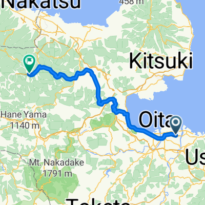
 oita - saganoseki
- Distance
- 67.6 km
- Ascent
- 667 m
- Descent
- 664 m
- Location
- Tsurusaki, Oita, Japan
 Tsurusaki - Tsukawaki
- Distance
- 82.3 km
- Ascent
- 691 m
- Descent
- 349 m
- Location
- Tsurusaki, Oita, Japan
Open it in the app