

木曽川沿川周遊サイクリング
A cycling route starting in Kōnan, Aichi, Japan.
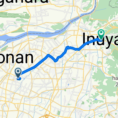
Overview
About this route
- -:--
- Duration
- 20.2 km
- Distance
- 47 m
- Ascent
- 53 m
- Descent
- ---
- Avg. speed
- ---
- Max. altitude

Continue with Bikemap
Use, edit, or download this cycling route
You would like to ride 木曽川沿川周遊サイクリング or customize it for your own trip? Here is what you can do with this Bikemap route:
Free features
- Save this route as favorite or in collections
- Copy & plan your own version of this route
- Sync your route with Garmin or Wahoo
Premium features
Free trial for 3 days, or one-time payment. More about Bikemap Premium.
- Navigate this route on iOS & Android
- Export a GPX / KML file of this route
- Create your custom printout (try it for free)
- Download this route for offline navigation
Discover more Premium features.
Get Bikemap PremiumFrom our community
Other popular routes starting in Kōnan
 Kusai, Konan to Kusaicho, Konan
- Distance
- 14.8 km
- Ascent
- 61 m
- Descent
- 62 m
- Location
- Kōnan, Aichi, Japan
 1丁目, 大口町 まで4792−1, 可児市
- Distance
- 16.3 km
- Ascent
- 156 m
- Descent
- 121 m
- Location
- Kōnan, Aichi, Japan
 Izumi, Konan to Daidōhigashi, Ichinomiya
- Distance
- 9.8 km
- Ascent
- 18 m
- Descent
- 27 m
- Location
- Kōnan, Aichi, Japan
 草井町, 江南市 to 草井町, 江南市
- Distance
- 20.9 km
- Ascent
- 391 m
- Descent
- 390 m
- Location
- Kōnan, Aichi, Japan
 Kōnan - Toyohashi
- Distance
- 101.3 km
- Ascent
- 674 m
- Descent
- 677 m
- Location
- Kōnan, Aichi, Japan
 336, Takeda 2-Chōme, Oguchi, Niwa-Gun to 国道156号, Gujo
- Distance
- 38.4 km
- Ascent
- 447 m
- Descent
- 357 m
- Location
- Kōnan, Aichi, Japan
 旭 まで杉ノ山
- Distance
- 11.9 km
- Ascent
- 46 m
- Descent
- 41 m
- Location
- Kōnan, Aichi, Japan
 イジラ湖
イジラ湖- Distance
- 38.8 km
- Ascent
- 182 m
- Descent
- 78 m
- Location
- Kōnan, Aichi, Japan
Open it in the app